
Building Regional Capacity in Egypt through the training on WATDEV Modelling Toolbox

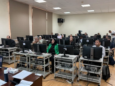
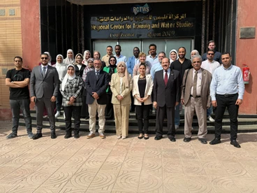
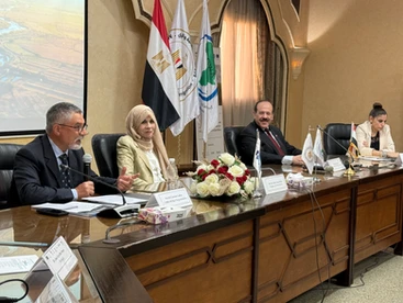
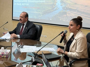
A further two-day Regional Training was held on 13–14 May 2026 at the Regional Training Centre for Water Resources and Irrigation (RTCWRI) in Cairo, with main topic the WATDEV Modelling Toolbox . The event marked another important milestone in WATDEV’s regional capacity-building activities and followed the successful regional training previously organized in Ethiopia.

The training was organized within the framework of the strong and fruitful collaboration between WATDEV and RTCWRI, bringing together water managers, researchers, and technical experts from Egypt, Sudan, Ethiopia, Tunisia, Netherlands, Finland, and Italy, many of whom have actively contributed to WATDEV activities throughout the past years.

In addition, the training welcomed a delegation of officials from relevant Egyptian Ministries involved in the Water Knowledge Project. Their participation aimed to strengthen collaboration and maximize synergies between the two initiatives in support of sustainable water management and climate-resilient agricultural development in Egypt.

Organised through the collaborative efforts of Heliopolis University, ISRIC, SYKE, CHIEAM BARI, ASARECA and the Italian Agency for Development Cooperation – AICS Cairo, the training combined theoretical presentations, practical tutorials, plenary discussions, and group exercises that allowed participants to directly apply the toolbox to real-world case studies.
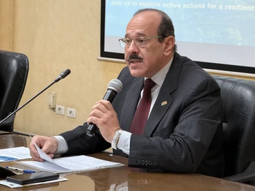
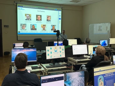
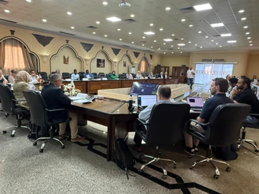
The first day of the training commenced with welcoming remarks by Prof. Wael Khairy, Heliopolis University, who welcomed all participants and highlighted the importance of WATDEV toolbox as a practical decision-support tool that transforms scientific knowledge and data into actionable solutions for policymakers, researchers and water managers addressing climate and water challenges. Ms. Concetta Bianco, WATDEV Project Coordinator at AICS Cairo, emphasised the importance of gathering user feedback to further improve the toolbox’s usability and effectiveness. In his remarks, Dr. Gaetano Ladisa, WATDEV Project Manager at CIHEAM Bari, underlined that the training aimed not only to strengthen capacities in the effective use of the WATDEV Toolbox for modelling, assessment, and planning of agricultural water management interventions, but also to engage end users in enhancing the platform’s functionality.

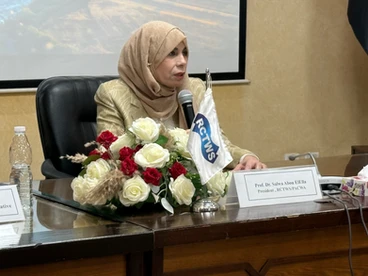
The opening session concluded with remarks from Prof. Salwa AbouElella, President of RTCWRI, who warmly welcomed participants and emphasized the importance of such collaborative initiatives, as well as the vital role of the WATDEV Toolbox in supporting informed and evidence-based decision-making processes.

Following the opening remarks, Dr. João Nunes, from ISRIC, introduced the WATDEV Toolbox as an innovative decision-support platform designed to support climate-smart water management and sustainable agricultural development through integrated modelling, scenario analysis, and evidence-based planning.

A key feature of the training was the use of real-world case studies from Sharqia Governorate in Egypt and Gezira in Sudan. These case studies demonstrated how the WATDEV Toolbox can support data-driven decision-making for sustainable water and agricultural management under different environmental and socioeconomic conditions.

Throughout the training, participants gained hands-on experience using the WATDEV Toolbox to visualize model results for Best Management Practices (BMPs), design new water and agricultural management scenarios, assess environmental, economic, and social impacts and conduct Multi-Criteria Analysis (MCA) to support evidence-based decisions

Group exercises enabled participants to explore and compare BMP scenarios, evaluate socioeconomic Key Performance Indicators (KPIs), conduct MCA using environmental and economic indicators, and discuss practical applications of the toolbox for planning and policy support. The second day focused on socioeconomic assessment and Multi-Criteria Analysis, with participants working in groups to explore individual case studies in greater detail.

The success of the training was made possible through the dedication and expertise of an outstanding team of lecturers and trainers, including Dr. João Nunes, Dr. Katri Rankinen, Dr. Aymen Sawassi, Rik Oudega together with the PhD students supported by WATDEV: Samar Gomaa, Mulugeta Melese, Mohammed Barsi. Through their technical guidance, practical demonstrations, and continuous engagement with participants, the lecturers played a key role in creating an interactive and impactful learning experience.

Beyond the technical sessions, the training provided an important platform for regional networking, knowledge exchange, and collaboration among institutions and professionals working in water and agriculture sectors.

The event concluded with a memorable dinner cruise on the Nile River, where participants had the opportunity to connect, exchange experiences, and celebrate the success of the training while enjoying the vibrant atmosphere and cultural spirit of Egypt.

Funded by the European Union under the DeSIRA Initiative, WATDEV project continues to empower water managers, researchers, and decision-makers with innovative tools and scientific knowledge to support more resilient, sustainable, and climate-smart food and agriculture systems across the region.

Photo Album

Leave a Comment

Your email address will not be published. Required fields are marked *

Scroll to Top

Ude Kebele groundwater irrigation scheme under the Adaa Becho Groundwater Irrigation system (ABGIS) in the Awash Basin

It is a new intervention area with perspectives to be expanded. It is therefore envisaged that the lessons from other countries could be scaled out in this area.

Ada’a-Becho Groundwater Irrigation (ABGIS) is located in Ada’a Wereda some 50 km from Addis Ababa. The Adama road passes nearby the scheme and has no access limitation.  This scheme is part of Ada’a-Bacho Irrigation Development Project that comprises three conjugate Kebeles (i.e., Dhankaka, Ude and Qallitty) in Ada’a District of East Shawa Zone, Oromia Regional State.

The Ude Kebele Groundwater Irrigation Site is small, scheme selected to demonstrate groundwater irrigation practice demonstration sites as it is new irrigation development area will be a learning site for a medium scale community owned groundwater irrigation development in Ethiopia.

ABGIS landscape is one of the low reliefs that slopes gently north-west and south east wards. Apart from close to the hills virtually all slopes are nearly less than 3- 4%, with the majority of the slopes of 0-2%. 

The climatic variables of the project area are highly governed by the topography of the area (mainly altitude). The highland area lies at an altitude of over 2300 m asl and covers 17.5% of the project area. Mean annual temperature of this part of the project area ranges from 12.50C to 160C.

The major crops produced include Teff, chick pea, wheat, barley, vetch, and maize.  Few farmers also produce tomato and onion as cash crops. Crop production in the area is by and large rain-dependent. But in few farmers produce vegetables twice a year using pumped water from Mojo and Waddecha rivers.

The problems in ABGIS are connected with the limited experience in fruit crop production.

Koga Irrigation System (KIS) in the Abbay Basin

KIS is an established and relatively well performing irrigation scheme in Ethiopia. In here besides Irrigation water management, there are also success stories in watershed management.

Koga is located some 40 km from Bahri Dar town (Regional capital of Amhara Regional State. The  Bahir Dar –Addis Ababa highway passes through the scheme (Fig 2), hence the scheme is year round accessible.

Koga irrigation system comprises of 19.7 km of lined main canal, 52 km of lined secondary canals, 156 km of unlined tertiary canals, 905 km of unlined quaternary canals and 11 lined Night Storage Reservoirs (NSRs). The main canal was designed to provide irrigation water for 24 h during irrigation period.

There are 12 secondary canals designed for 12 h irrigation supply each covering an area of irrigated land ranging from 220 ha to over 1000 ha. Tertiary canals are designed for 12 h irrigation supply. The area irrigated by a tertiary canal range between 20 ha to 65 ha. The quaternary canals have a capacity of irrigating 8–16 ha of land while field canals will serve an area of 2.0 ha within the quaternary unit. The maximum field canal design capacity is 30 l/s.

KIS is the best performing among many community-managed irrigation schemes. Unlike other schemes this was designed and developed as an integrated watershed and irrigation development project.

Among the problems associated to the KIS are Seasonal water shortage and associated conflicts between Irrigation water user associations, low irrigation water application efficiency, catchment degradation. In order to increase water productivity in the KIS, water saving technologies will be promoted.

The Gezira irrigation scheme

The Gezira Scheme is located between the Blue Nile and the White Nile Rivers within a semi-arid agro-climatic zone. In terms of accessibility, it is easily accessible by Wad Medani road and the trip between Wad Medani, the capital of the Gezira State and headquarter of the scheme (Barakat), and Khartoum takes about three hours. The scheme is one of the largest irrigation schemes in the region with 880,000 hectares (ha). It is one of the main sources of foreign currency (cotton export), and food security (wheat, sorghum, vegetables) for Sudan. It has huge infrastructure with a value estimated at about US $ 8 billion. The scheme had played a vital role in the history of irrigation in Sudan and Africa and has become a model for many irrigation schemes in sub-Saharan Africa in terms of design and operation system. Therefore, any research aiming at improving water management in Gezira scheme is not only beneficial to the project, but also to similar projects at national and regional scale.  There are many challenges that the scheme face and urgent need to investigate Best Management Practices (BMPs) that  can overcome these challenges and enhance productivity. Some of these challenges are deterioration of irrigation infrastructure, inefficient water distribution within the scheme, agricultural drainage discharges directly in the Blue Nile without treatment impacting water quality, institutional weakness and instability.

Belbies district

Belbies district is located 20 km south of El Zagazig city between Long. 31o 24′ and 31o 39′ E and Lat. 30o 19′ and 30o 29′ N. It is bounded at the east by Abu Hammad, at the west by Minia El Kammh and in the south by the Tenth of Ramadan City districts.

As a part of the east Nile Delta, Belbies district constitutes a portion of an arid belt of north Egypt. It is characterized by a long dry summer and short temperate winter with a rainfall period from October to March. The climate is hot in summer; the average temperature is in the range of 19.7oC and 34.7oC, while during winter it ranges from 7.4oC and 18.4oC.

Due to intensive agricultural practice, which involves the application of chemical fertilizers and pesticides, many soils and shallow aquifers are contaminated. Consequently, pollution of groundwater has become a major concern in recent years. Wastewater disposed in canals can diffuse in groundwater. Overexploitation of groundwater and intensive irrigation in major canal commands has posed serious problems for groundwater managers in Nile Delta e.g. Sharkia governorate. The development of groundwater resources, technology-oriented management skills, adequate and efficient groundwater monitoring system, empowerment of women in unprivileged areas are among the challenges to be addressed. Indeed, water management projects are one of the priority topics in the political agenda of Egypt.