Dissemination of Climate-Smart BMPs in wider communities in Ethiopia

The WATDEV project has officially launched its series of regional trainings on Best Management Practices (BMPs) and Innovations in Wider Areas, starting with a two-day event held on 23???24 March 2026 in Arba Minch, Ethiopia. Organised by WATDEV local partner Water and Land Resource Center ??? WLRC Ethiopian, in collaboration with CIHEAM Bari and ASARECA, the training marks a significant step toward expanding WATDEV knowledge beyond initial pilot study areas and strengthening the capacity of local communities to adopt climate-smart agricultural practices.

The training focuses on disseminating and upscaling validated BMPs by translating research outcomes into practical knowledge and skills for farmers and local stakeholders. Building on the results of earlier Local Feedback Meetings, the initiative aims to support the adaptation and replication of sustainable agricultural water management solutions in new contexts.

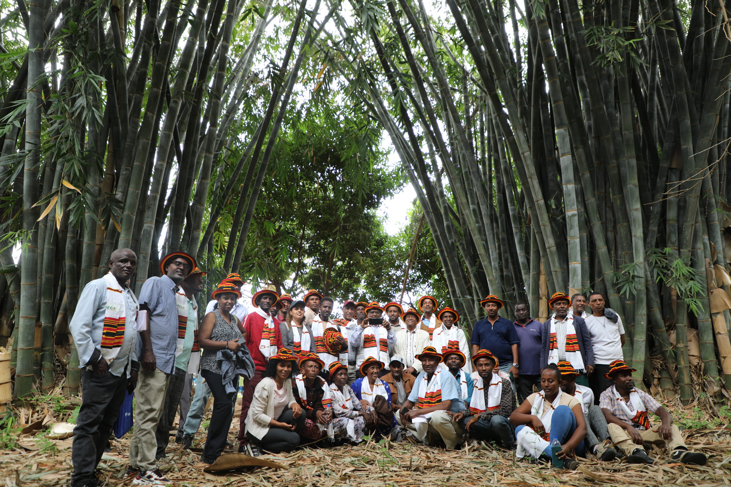
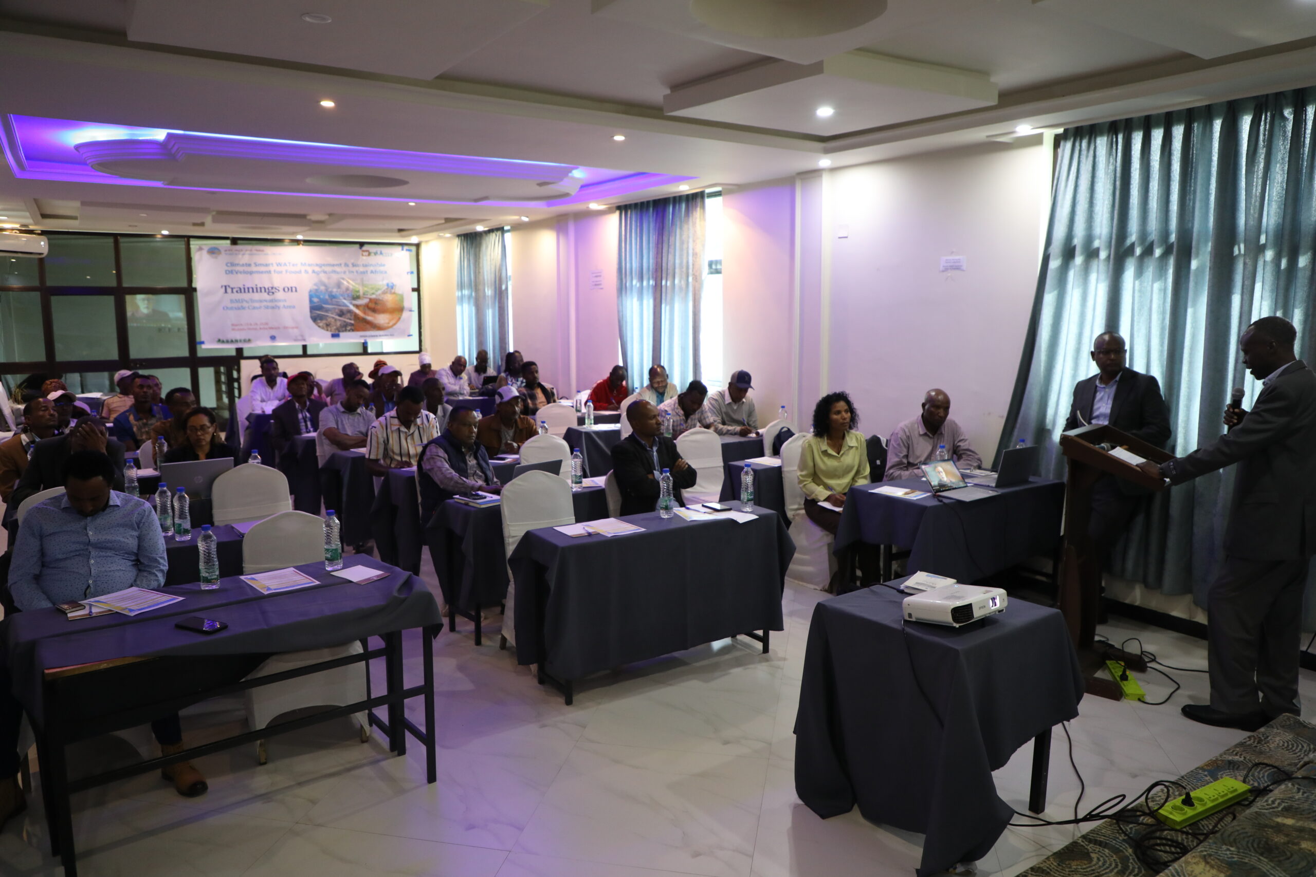
The training brought together farmers, experts, and local actors in an interactive learning environment designed to foster knowledge exchange and community engagement.

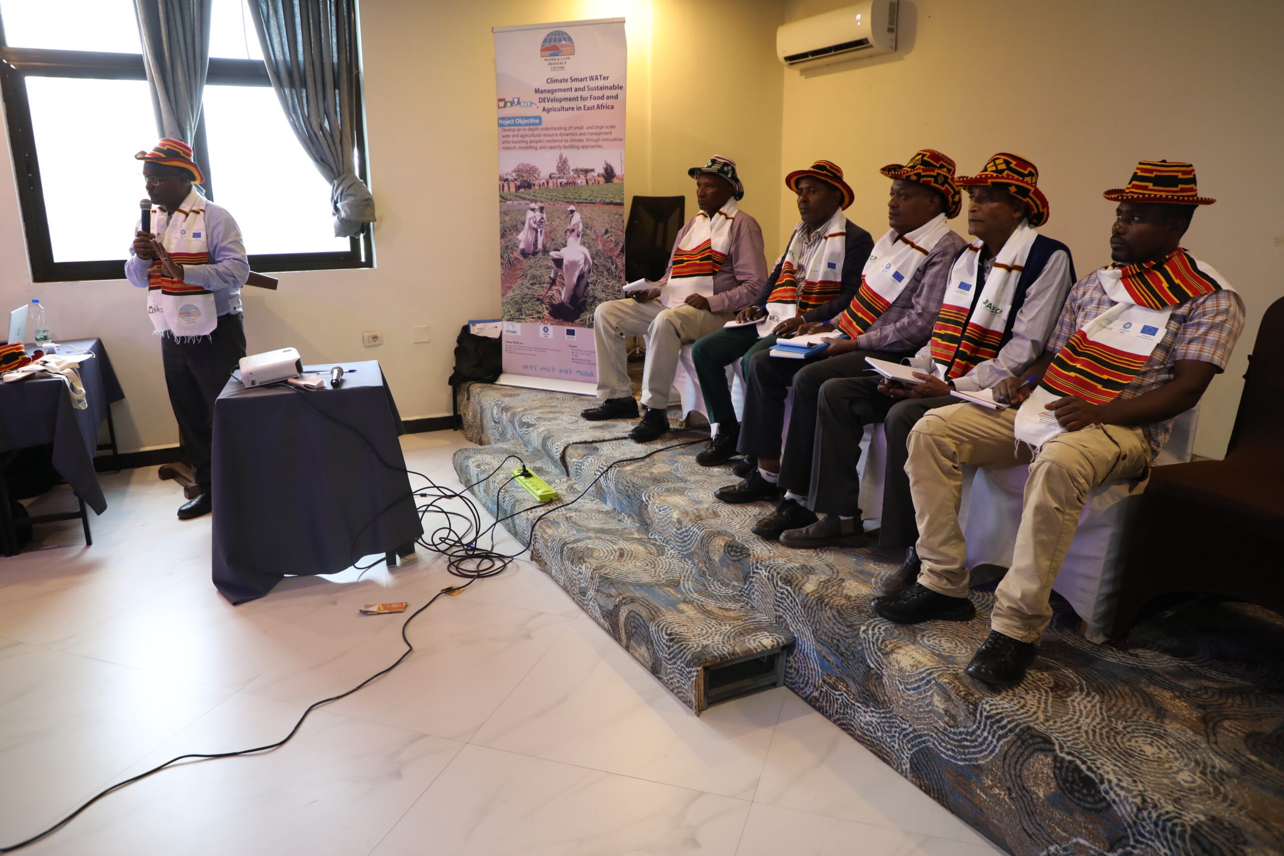
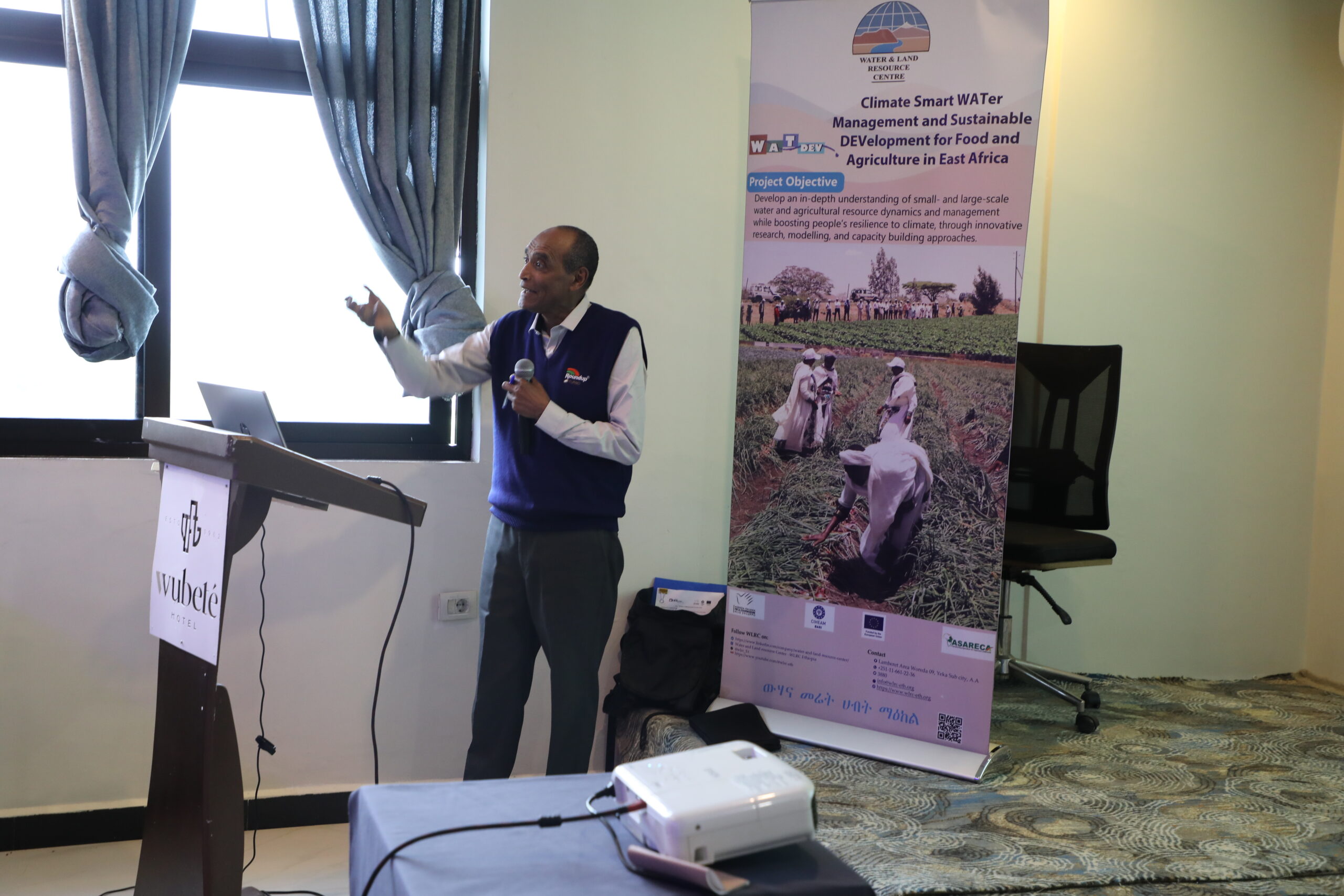
The first day commenced with welcoming remarks by the Zone Administration Head, followed by opening remarks by Dr. Gaetano Ladisa, WATDEV Project Manager at CIHEAM-Bari, who highlighted the project’s commitment to expanding its knowledge and impact to wider communities, fostering the uptake of climate-smart and sustainable agricultural water management practices. An overview of WATDEV project and its objectives was then presented by WLRC, setting the stage for the training. Subsequently, Mr. Moses Odeke from ASARECA introduced the meeting agenda and objectives, emphasizing the importance of knowledge exchange, local engagement, and the practical adaptation of BMPs to local context as key drivers for enhancing sustainable agricultural water management.

This was followed by a comprehensive presentation of the selected BMPs in Ethiopia, which covered:

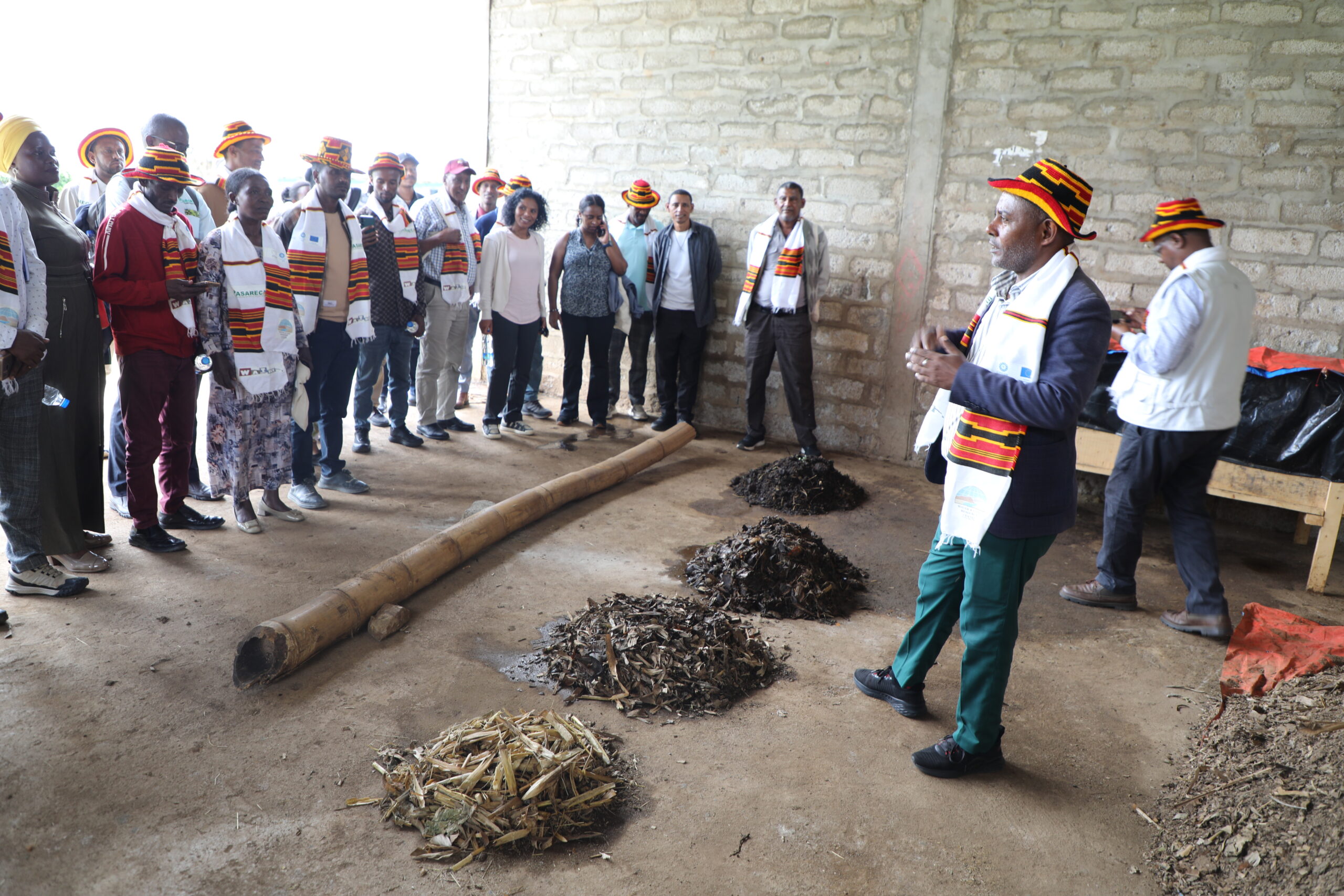
??      Soil health, including composting (vermicompost and vermi-tea), Integrated Soil Fertility Management (ISFM), application of effective microorganisms, soil testing, and conservation agriculture;

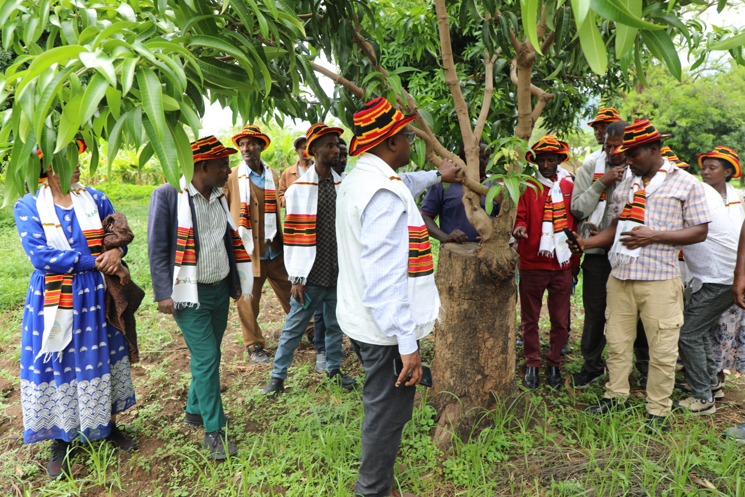
??      Agroforestry, highlighting opportunities for integrating tree crops such as banana, avocado, and mango;

??      Irrigation and water management, focusing on the organization of water user associations, equitable water allocation, and conflict resolution mechanisms; and

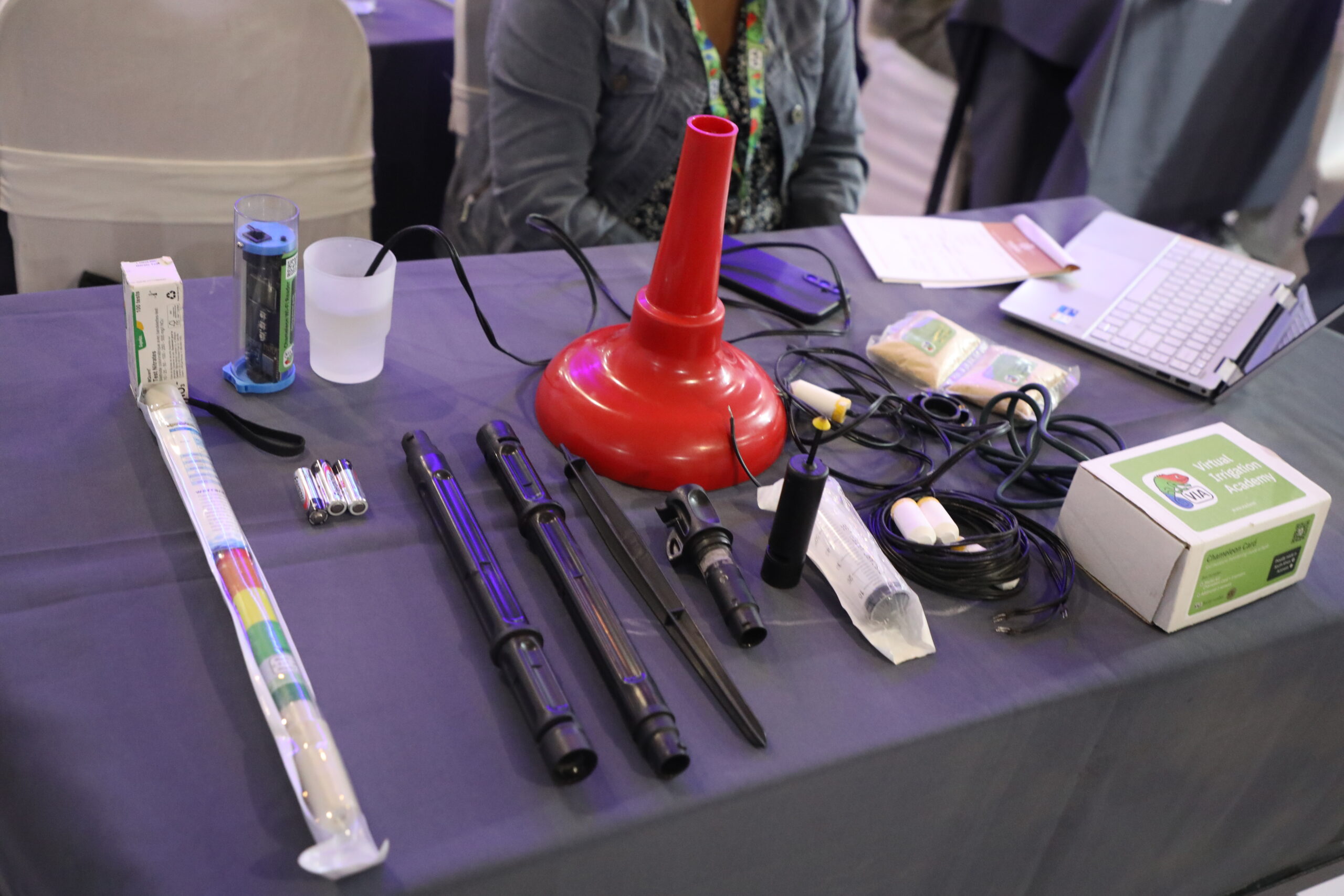
??      Climate-smart water and nutrient monitoring tools, including virtual irrigation approaches for efficient resource management.

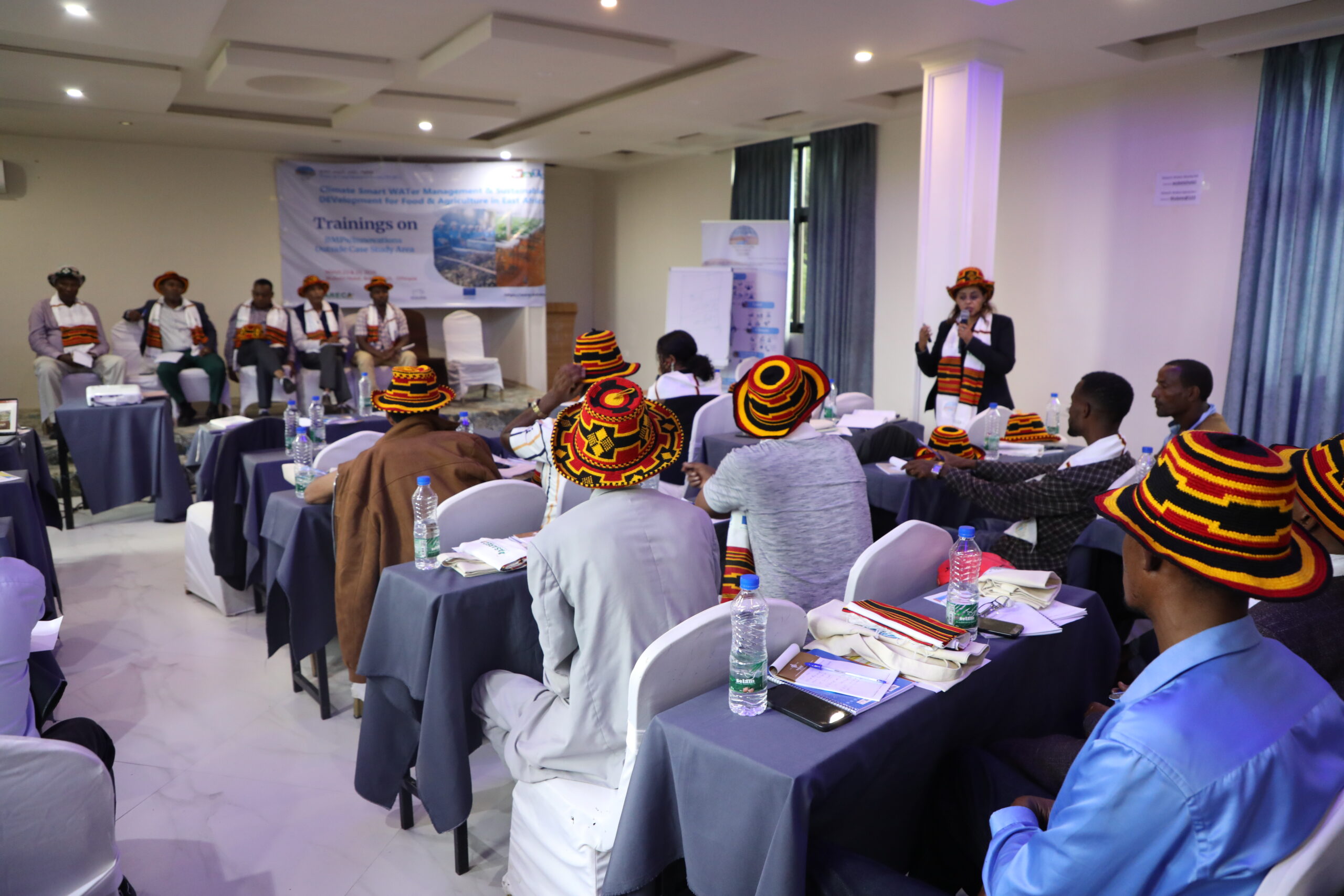
The training combined theoretical and experiential learning approaches, delivered through presentations alongside peer-to-peer knowledge exchange. Farmers from the project area (Koga) actively contributed by sharing their success stories, experiences, and lessons learned, enriching the discussions with practical, field-based perspectives.

Day 2 shifted towards hands-on implementation, featuring live demonstrations of the selected BMPs. Trainers guided participants through the preparation of vermicompost and vermi-tea, demonstrating production processes, application methods, and appropriate storage conditions.

The programme also included a field visit to Gamo nursery site, where participants explored a variety of agroforestry tree seedlings and gained insights into their integration within farming systems. In addition, farmers were introduced to solar-powered irrigation systems, highlighting sustainable water use solutions. The field visit concluded with practical demonstrations on the installation and use of soil moisture and nutrient monitoring tools, equipping participants with innovative techniques to support efficient and climate-smart farm management.

A central element of the training was its emphasis on co-creation. Through open discission and field interactions, participants were encouraged to share their experiences and insights, contributing to the refinement of the BMPs implementation approaches.

This participatory approach enabled the collection of valuable feedback on the feasibility of the BMPs, as well as the identification of key enabling factors and barriers to their adoption. While challenges such as limited access to training and financial resources were raised up, participants expressed strong interest in adopting innovative solutions, particularly climate-smart monitoring tools for improved water and nutrient management and their willing to adopt the BMPs.

By integrating local insights, the training contributes to enhancing the relevance, applicability, and scalability of BMPs across diverse contexts, in line with WATDEV???s broader objective of strengthening resilience to climate change through sustainable agricultural water management.

Funded by the European Union, under the DeSIRA Initiative, WATDEV continues to reinforce its commitment through targeted capacity-building efforts, to empower local communities with the practical knowledge and tools needed to implement innovative solutions, improve productivity, and reduce environmental impacts.

Photo Album

Leave a Comment

Your email address will not be published. Required fields are marked *

Scroll to Top

Ude Kebele groundwater irrigation scheme under the Adaa Becho Groundwater Irrigation system (ABGIS) in the Awash Basin

It is a new intervention area with perspectives to be expanded. It is therefore envisaged that the lessons from other countries could be scaled out in this area.

Ada’a-Becho Groundwater Irrigation (ABGIS) is located in Ada’a Wereda some 50 km from Addis Ababa. The Adama road passes nearby the scheme and has no access limitation.  This scheme is part of Ada’a-Bacho Irrigation Development Project that comprises three conjugate Kebeles (i.e., Dhankaka, Ude and Qallitty) in Ada’a District of East Shawa Zone, Oromia Regional State.

The Ude Kebele Groundwater Irrigation Site is small, scheme selected to demonstrate groundwater irrigation practice demonstration sites as it is new irrigation development area will be a learning site for a medium scale community owned groundwater irrigation development in Ethiopia.

ABGIS landscape is one of the low reliefs that slopes gently north-west and south east wards. Apart from close to the hills virtually all slopes are nearly less than 3- 4%, with the majority of the slopes of 0-2%. 

The climatic variables of the project area are highly governed by the topography of the area (mainly altitude). The highland area lies at an altitude of over 2300 m asl and covers 17.5% of the project area. Mean annual temperature of this part of the project area ranges from 12.50C to 160C.

The major crops produced include Teff, chick pea, wheat, barley, vetch, and maize.  Few farmers also produce tomato and onion as cash crops. Crop production in the area is by and large rain-dependent. But in few farmers produce vegetables twice a year using pumped water from Mojo and Waddecha rivers.

The problems in ABGIS are connected with the limited experience in fruit crop production.

Koga Irrigation System (KIS) in the Abbay Basin

KIS is an established and relatively well performing irrigation scheme in Ethiopia. In here besides Irrigation water management, there are also success stories in watershed management.

Koga is located some 40 km from Bahri Dar town (Regional capital of Amhara Regional State. The  Bahir Dar –Addis Ababa highway passes through the scheme (Fig 2), hence the scheme is year round accessible.

Koga irrigation system comprises of 19.7 km of lined main canal, 52 km of lined secondary canals, 156 km of unlined tertiary canals, 905 km of unlined quaternary canals and 11 lined Night Storage Reservoirs (NSRs). The main canal was designed to provide irrigation water for 24 h during irrigation period.

There are 12 secondary canals designed for 12 h irrigation supply each covering an area of irrigated land ranging from 220 ha to over 1000 ha. Tertiary canals are designed for 12 h irrigation supply. The area irrigated by a tertiary canal range between 20 ha to 65 ha. The quaternary canals have a capacity of irrigating 8–16 ha of land while field canals will serve an area of 2.0 ha within the quaternary unit. The maximum field canal design capacity is 30 l/s.

KIS is the best performing among many community-managed irrigation schemes. Unlike other schemes this was designed and developed as an integrated watershed and irrigation development project.

Among the problems associated to the KIS are Seasonal water shortage and associated conflicts between Irrigation water user associations, low irrigation water application efficiency, catchment degradation. In order to increase water productivity in the KIS, water saving technologies will be promoted.

The Gezira irrigation scheme

The Gezira Scheme is located between the Blue Nile and the White Nile Rivers within a semi-arid agro-climatic zone. In terms of accessibility, it is easily accessible by Wad Medani road and the trip between Wad Medani, the capital of the Gezira State and headquarter of the scheme (Barakat), and Khartoum takes about three hours. The scheme is one of the largest irrigation schemes in the region with 880,000 hectares (ha). It is one of the main sources of foreign currency (cotton export), and food security (wheat, sorghum, vegetables) for Sudan. It has huge infrastructure with a value estimated at about US $ 8 billion. The scheme had played a vital role in the history of irrigation in Sudan and Africa and has become a model for many irrigation schemes in sub-Saharan Africa in terms of design and operation system. Therefore, any research aiming at improving water management in Gezira scheme is not only beneficial to the project, but also to similar projects at national and regional scale.  There are many challenges that the scheme face and urgent need to investigate Best Management Practices (BMPs) that  can overcome these challenges and enhance productivity. Some of these challenges are deterioration of irrigation infrastructure, inefficient water distribution within the scheme, agricultural drainage discharges directly in the Blue Nile without treatment impacting water quality, institutional weakness and instability.

Belbies district

Belbies district is located 20 km south of El Zagazig city between Long. 31o 24′ and 31o 39′ E and Lat. 30o 19′ and 30o 29′ N. It is bounded at the east by Abu Hammad, at the west by Minia El Kammh and in the south by the Tenth of Ramadan City districts.

As a part of the east Nile Delta, Belbies district constitutes a portion of an arid belt of north Egypt. It is characterized by a long dry summer and short temperate winter with a rainfall period from October to March. The climate is hot in summer; the average temperature is in the range of 19.7oC and 34.7oC, while during winter it ranges from 7.4oC and 18.4oC.

Due to intensive agricultural practice, which involves the application of chemical fertilizers and pesticides, many soils and shallow aquifers are contaminated. Consequently, pollution of groundwater has become a major concern in recent years. Wastewater disposed in canals can diffuse in groundwater. Overexploitation of groundwater and intensive irrigation in major canal commands has posed serious problems for groundwater managers in Nile Delta e.g. Sharkia governorate. The development of groundwater resources, technology-oriented management skills, adequate and efficient groundwater monitoring system, empowerment of women in unprivileged areas are among the challenges to be addressed. Indeed, water management projects are one of the priority topics in the political agenda of Egypt.