WATDEV project presented and discussed with stakeholders in Bahir Dar, Ethiopia

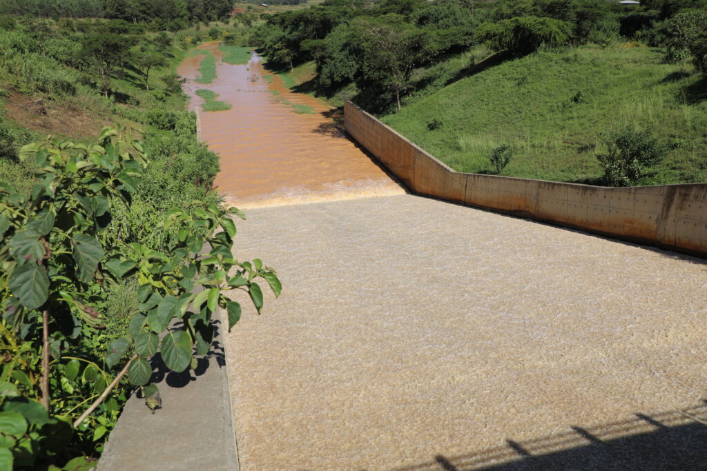
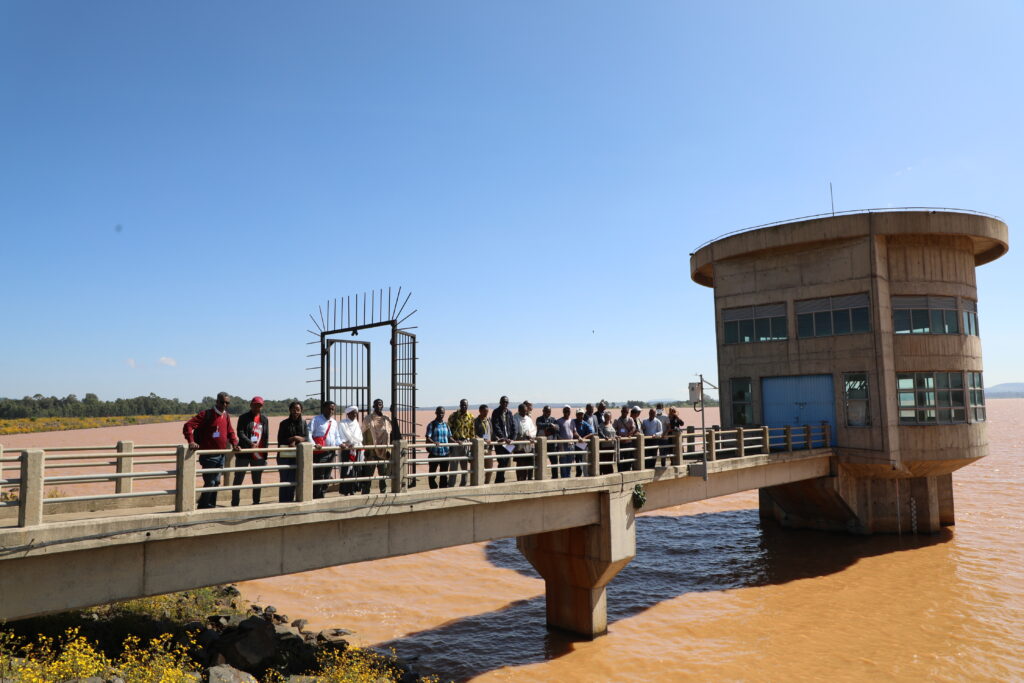
WATDEV activities in Ethiopia are focused on the Koga Irrigation System (KIS) in the Abbay Basin, located 40km from Bahir Dar town. In this study area it will be possible to draw lessons learnt in the catchment management and scale best practices on irrigation water management and sustainable land management.

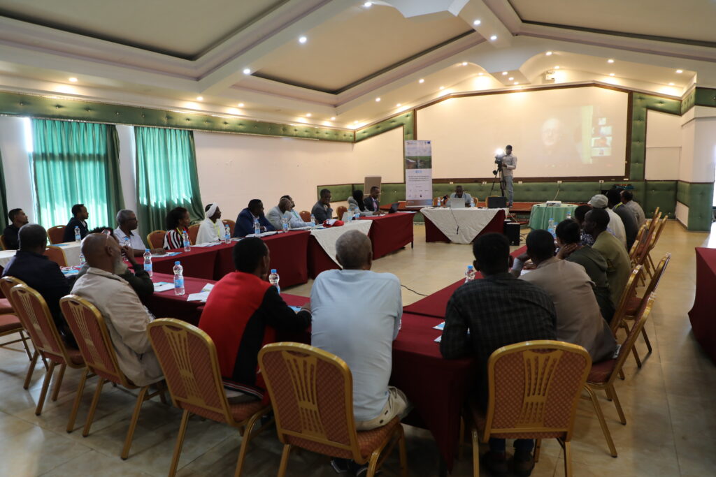
The first stakeholder meeting in Ethiopia was held in Bahir Dar, on October 26-27, 2022, to analyze existing best management practices (BMPs) in the study area while identifying challenges, opportunities, and methods of improvement of irrigation water management and sustainable land management.

The event was hosted by the Water and Land Resource Centre (WLRC) of Addis Ababa University, partner of WATDEV initiative, and organized in cooperation with the Association for Strengthening Agricultural Research in Eastern and Central Africa (ASARECA) and the Mediterranean Agronomic Institute of Bari (CIHEAM Bari).

Dr. Almaz Gizew

The Deputy Head of Agriculture of the Bureau of Agriculture (BOA) of the Amhara Regional State (ARS), Her Excellency Dr. Almaz Gizew, welcomed participants to Bahir Dar, the ARS Capital. In her introductive speech, she underlined that food and nutrition insecurity is prevalent in the Amhara Regional State – an issue that requires concerted efforts by all the stakeholders to transform agricultural practices focusing on opportunities in irrigation agriculture. Dr. Almaz further noted that the Regional Government, in partnership with the Federal Government, has prioritized the development of the country’s water resources for irrigation as a major entry point to stabilize food security, especially at a time when global and regional food systems are vulnerable due to global food crises.

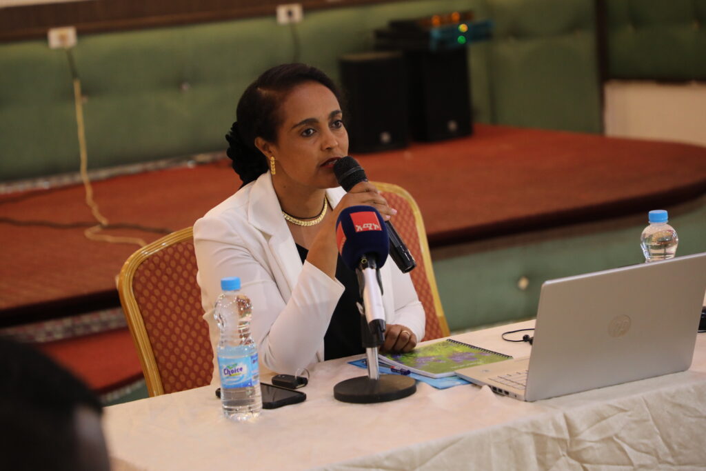
The representative of AICS Addis Ababa, Ms. Silvia Vanzetti, delivered an introductory note highlighting how WATDEV will allow the development of useful tools that will complement the activities of AICS Ethiopia in supporting the Ministry of Water and Energy to implement integrated water resource management. Ms. Margherita Tenedini, AICS Cairo representative and WATDEV coordinator, welcomed the participants and gave an overview of the Italian Cooperation activities in the sector of environmental protection and sustainable agriculture

Dr. Tena Alamirew

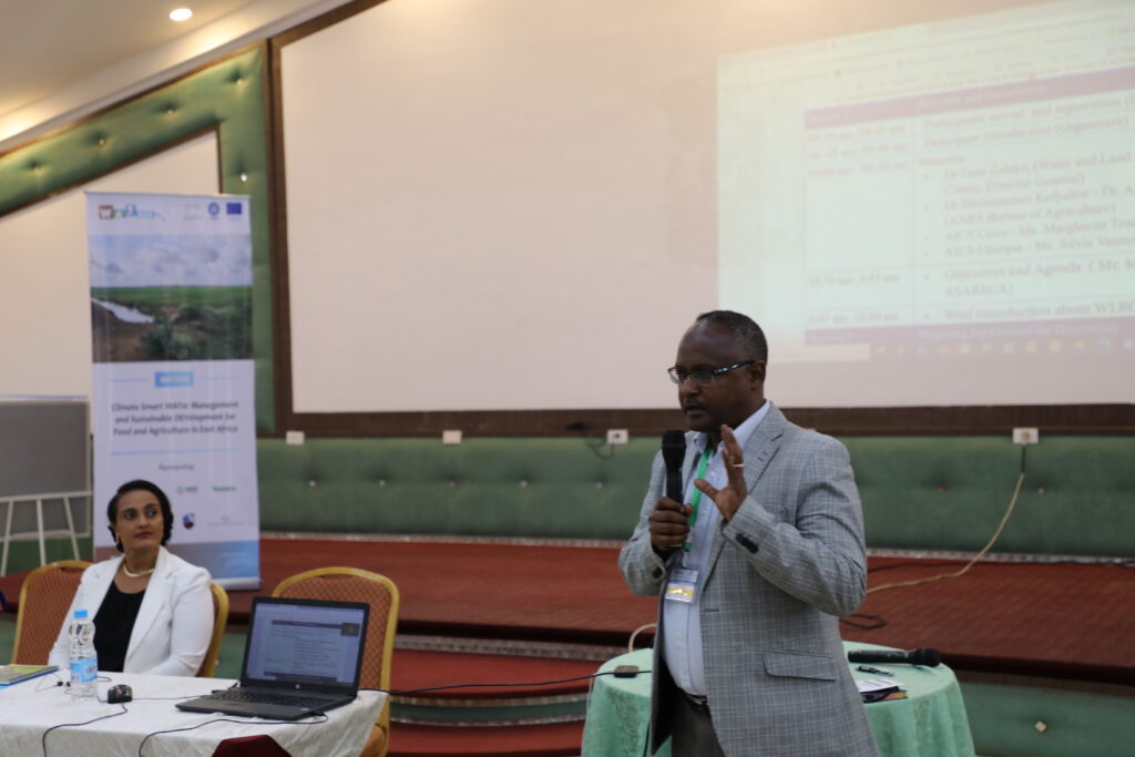
Dr. Tena Alamirew from WLRC made a presentation on the objectives of the meeting as well as the whole agenda of the two-day event. Together with Mr. Moses Odeke (ASARECA), he facilitated the entire discussion on local needs assessment, considering possible sectors of application of best management practices, such as groundwater, soil, crop, surface water, and air/atmosphere and stimulating a debate on preservation, exploitation, management of various BMPs under these sectors.

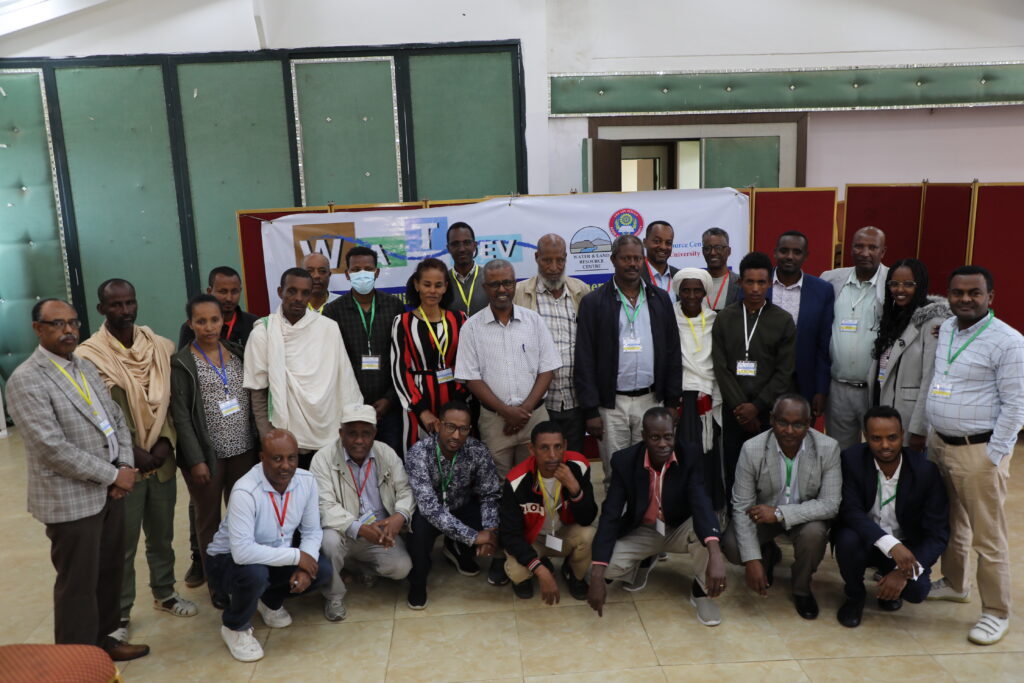
Thirty-three local stakeholders and six consortium members participated to the meeting. The public sector was represented by the Ministry of Water and Energy (MoWE), the Bureau of Agriculture for the Amhara Regional State, the Federal Parliament (Republic of Ethiopia), the Ministry of Agriculture, the Bureau of Agriculture, Water and Cooperatives Development. Stakeholders from research and academia comprised the Ethiopian Institute of Agriculture (EIARI), the Bahir Dar University, the Amhara Regional Agricultural Research Institute (ARARI), and other researchers and consultants. Other stakeholders included the Koga Dam Operators, experts from the Woreda District Agricultural and Irrigation Management Extension, the Irrigation Water Users Association, the Koga Farmers Union, and lead farmers and private irrigation companies.

WATDEV objectives, methods and expected results were presented by Aymen Sawassi from CIHEAM Bari. Finally, an information on the outcome of the best management practices collection was illustrated by the National Research Council of Italy. It was underlined that the BMPs aim is to enhance and improve, and in some cases correct, the positive balance between the human and environmental subsystems.

On October 27th, the group of participants visited the Koga Irrigation Dam, Irrigation Users Union Cold Storage Facility and Irrigation farms. A final session of discussion was held in the afternoon among WATDEV partners to share and discuss their assessment on group of stakeholders’ attitudes on adopting changes and cooperating among themselves.

The outcome of the discussion and assessment undertaken during the meeting with local stakeholders will be matched with the inventory of best management practices to find those practices that best fit the needs and group’s attitude, and which should be transferred or improved locally.

Photo Gallery

Leave a Comment

Your email address will not be published. Required fields are marked *

Scroll to Top

Ude Kebele groundwater irrigation scheme under the Adaa Becho Groundwater Irrigation system (ABGIS) in the Awash Basin

It is a new intervention area with perspectives to be expanded. It is therefore envisaged that the lessons from other countries could be scaled out in this area.

Ada’a-Becho Groundwater Irrigation (ABGIS) is located in Ada’a Wereda some 50 km from Addis Ababa. The Adama road passes nearby the scheme and has no access limitation.  This scheme is part of Ada’a-Bacho Irrigation Development Project that comprises three conjugate Kebeles (i.e., Dhankaka, Ude and Qallitty) in Ada’a District of East Shawa Zone, Oromia Regional State.

The Ude Kebele Groundwater Irrigation Site is small, scheme selected to demonstrate groundwater irrigation practice demonstration sites as it is new irrigation development area will be a learning site for a medium scale community owned groundwater irrigation development in Ethiopia.

ABGIS landscape is one of the low reliefs that slopes gently north-west and south east wards. Apart from close to the hills virtually all slopes are nearly less than 3- 4%, with the majority of the slopes of 0-2%. 

The climatic variables of the project area are highly governed by the topography of the area (mainly altitude). The highland area lies at an altitude of over 2300 m asl and covers 17.5% of the project area. Mean annual temperature of this part of the project area ranges from 12.50C to 160C.

The major crops produced include Teff, chick pea, wheat, barley, vetch, and maize.  Few farmers also produce tomato and onion as cash crops. Crop production in the area is by and large rain-dependent. But in few farmers produce vegetables twice a year using pumped water from Mojo and Waddecha rivers.

The problems in ABGIS are connected with the limited experience in fruit crop production.

Koga Irrigation System (KIS) in the Abbay Basin

KIS is an established and relatively well performing irrigation scheme in Ethiopia. In here besides Irrigation water management, there are also success stories in watershed management.

Koga is located some 40 km from Bahri Dar town (Regional capital of Amhara Regional State. The  Bahir Dar –Addis Ababa highway passes through the scheme (Fig 2), hence the scheme is year round accessible.

Koga irrigation system comprises of 19.7 km of lined main canal, 52 km of lined secondary canals, 156 km of unlined tertiary canals, 905 km of unlined quaternary canals and 11 lined Night Storage Reservoirs (NSRs). The main canal was designed to provide irrigation water for 24 h during irrigation period.

There are 12 secondary canals designed for 12 h irrigation supply each covering an area of irrigated land ranging from 220 ha to over 1000 ha. Tertiary canals are designed for 12 h irrigation supply. The area irrigated by a tertiary canal range between 20 ha to 65 ha. The quaternary canals have a capacity of irrigating 8–16 ha of land while field canals will serve an area of 2.0 ha within the quaternary unit. The maximum field canal design capacity is 30 l/s.

KIS is the best performing among many community-managed irrigation schemes. Unlike other schemes this was designed and developed as an integrated watershed and irrigation development project.

Among the problems associated to the KIS are Seasonal water shortage and associated conflicts between Irrigation water user associations, low irrigation water application efficiency, catchment degradation. In order to increase water productivity in the KIS, water saving technologies will be promoted.

The Gezira irrigation scheme

The Gezira Scheme is located between the Blue Nile and the White Nile Rivers within a semi-arid agro-climatic zone. In terms of accessibility, it is easily accessible by Wad Medani road and the trip between Wad Medani, the capital of the Gezira State and headquarter of the scheme (Barakat), and Khartoum takes about three hours. The scheme is one of the largest irrigation schemes in the region with 880,000 hectares (ha). It is one of the main sources of foreign currency (cotton export), and food security (wheat, sorghum, vegetables) for Sudan. It has huge infrastructure with a value estimated at about US $ 8 billion. The scheme had played a vital role in the history of irrigation in Sudan and Africa and has become a model for many irrigation schemes in sub-Saharan Africa in terms of design and operation system. Therefore, any research aiming at improving water management in Gezira scheme is not only beneficial to the project, but also to similar projects at national and regional scale.  There are many challenges that the scheme face and urgent need to investigate Best Management Practices (BMPs) that  can overcome these challenges and enhance productivity. Some of these challenges are deterioration of irrigation infrastructure, inefficient water distribution within the scheme, agricultural drainage discharges directly in the Blue Nile without treatment impacting water quality, institutional weakness and instability.

Belbies district

Belbies district is located 20 km south of El Zagazig city between Long. 31o 24′ and 31o 39′ E and Lat. 30o 19′ and 30o 29′ N. It is bounded at the east by Abu Hammad, at the west by Minia El Kammh and in the south by the Tenth of Ramadan City districts.

As a part of the east Nile Delta, Belbies district constitutes a portion of an arid belt of north Egypt. It is characterized by a long dry summer and short temperate winter with a rainfall period from October to March. The climate is hot in summer; the average temperature is in the range of 19.7oC and 34.7oC, while during winter it ranges from 7.4oC and 18.4oC.

Due to intensive agricultural practice, which involves the application of chemical fertilizers and pesticides, many soils and shallow aquifers are contaminated. Consequently, pollution of groundwater has become a major concern in recent years. Wastewater disposed in canals can diffuse in groundwater. Overexploitation of groundwater and intensive irrigation in major canal commands has posed serious problems for groundwater managers in Nile Delta e.g. Sharkia governorate. The development of groundwater resources, technology-oriented management skills, adequate and efficient groundwater monitoring system, empowerment of women in unprivileged areas are among the challenges to be addressed. Indeed, water management projects are one of the priority topics in the political agenda of Egypt.