WATDEV Project Promotes Agroforestry and the other BMPs in Tana River County Kenya

By Genevieve Apio

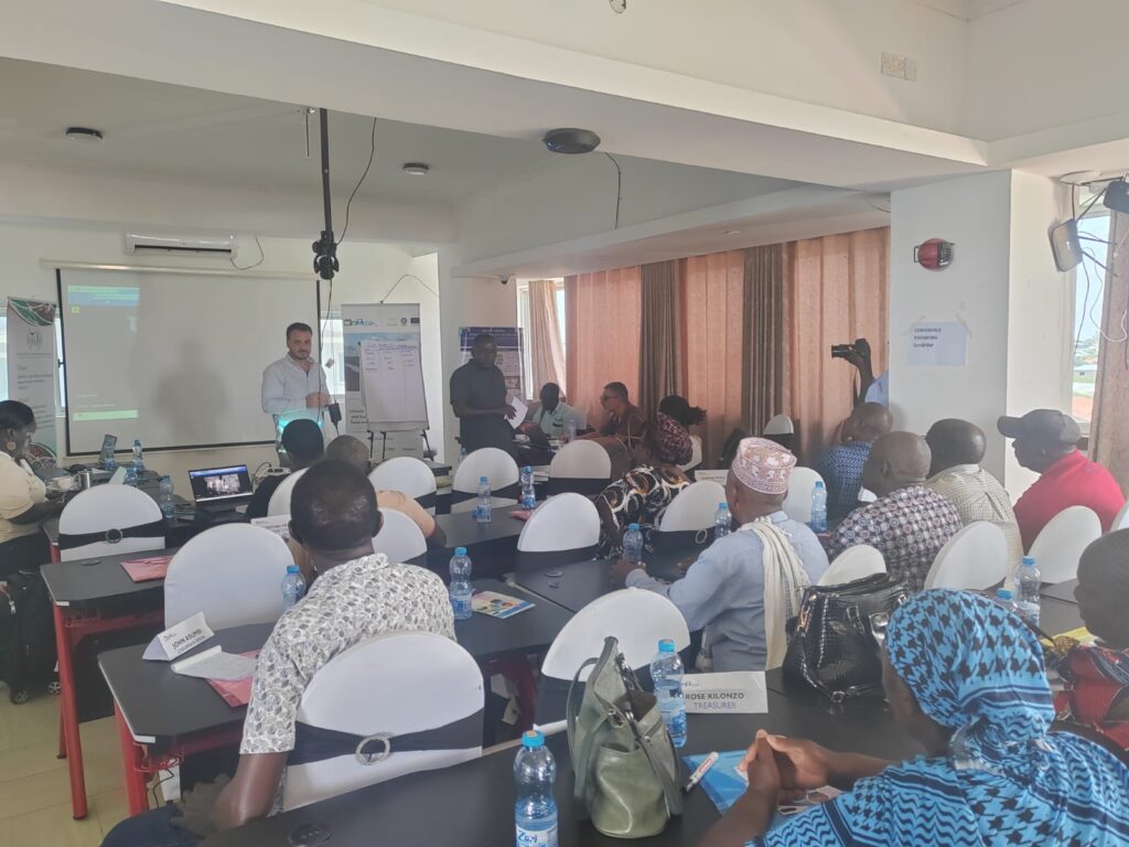
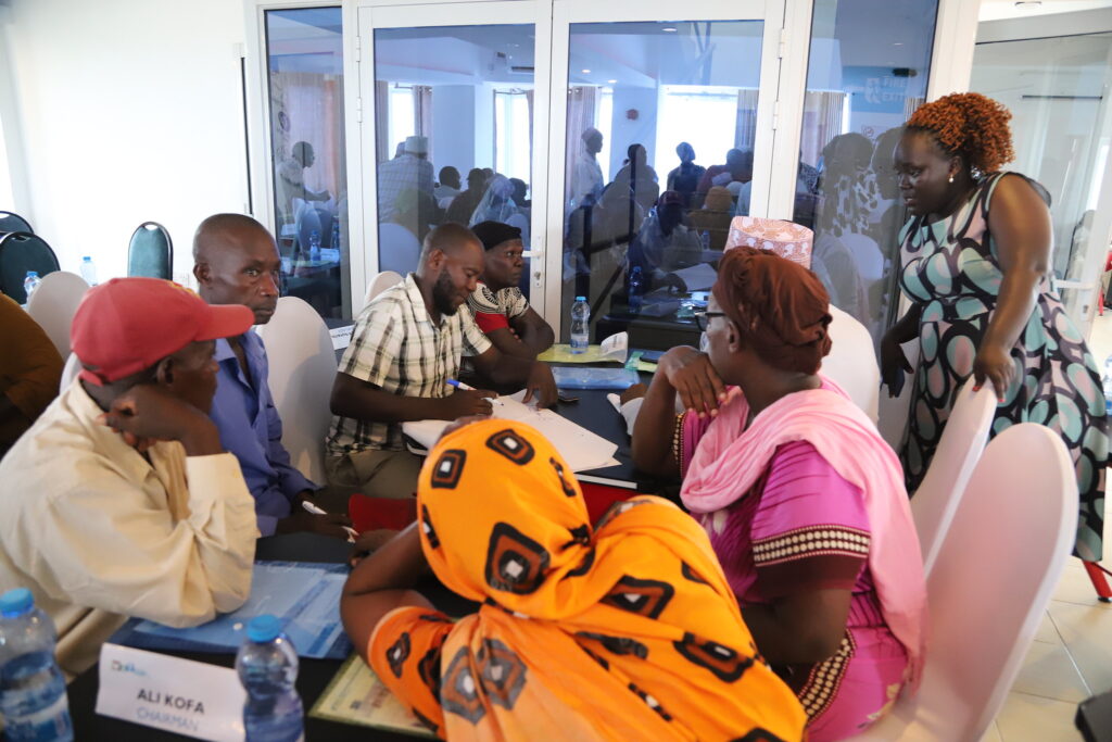
Tana River County, Kenya ??? The Follow Up Training and Innovation Roadshow and Exhibition convened participants at the Hola Irrigation Farmers??? Cooperative Society Ground on 24th and 25th March. The event, labelled as a Field day, aimed at showcasing technologies, innovations, and best practices to enhance the implementation of agroforestry and water management Best Management Practices (BMPs).

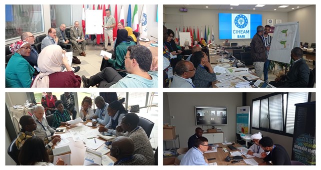
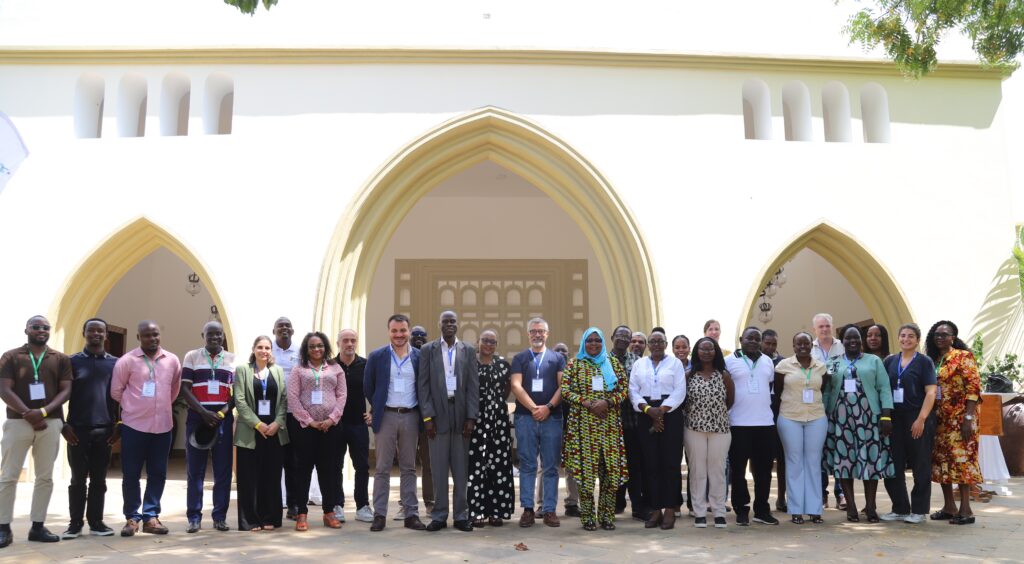
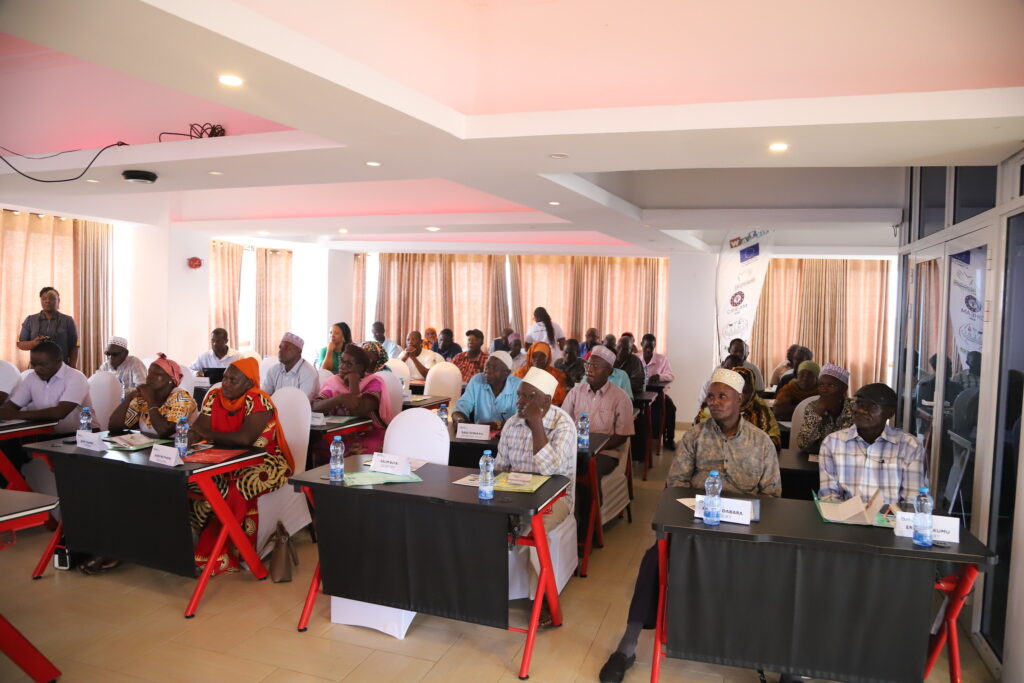
The project is funded by the European Union through the DeSIRA initiative, with AICS as the executing body and CIHEAM Bari as the technical and scientific lead partner. The event was facilitated by ASARECA in collaboration with KALRO and the Tana River County Government and attracted over 700 participants, including women, youth, farmers, agripreneurs, startups, researchers, and policymakers for training and exhibition.

The activity aimed to promote technologies, innovations, and best practices linked to agroforestry and sustainable water management systems to enhance agricultural productivity and resilience to climate change.

Promoting Agroforestry and Water Management BMPs

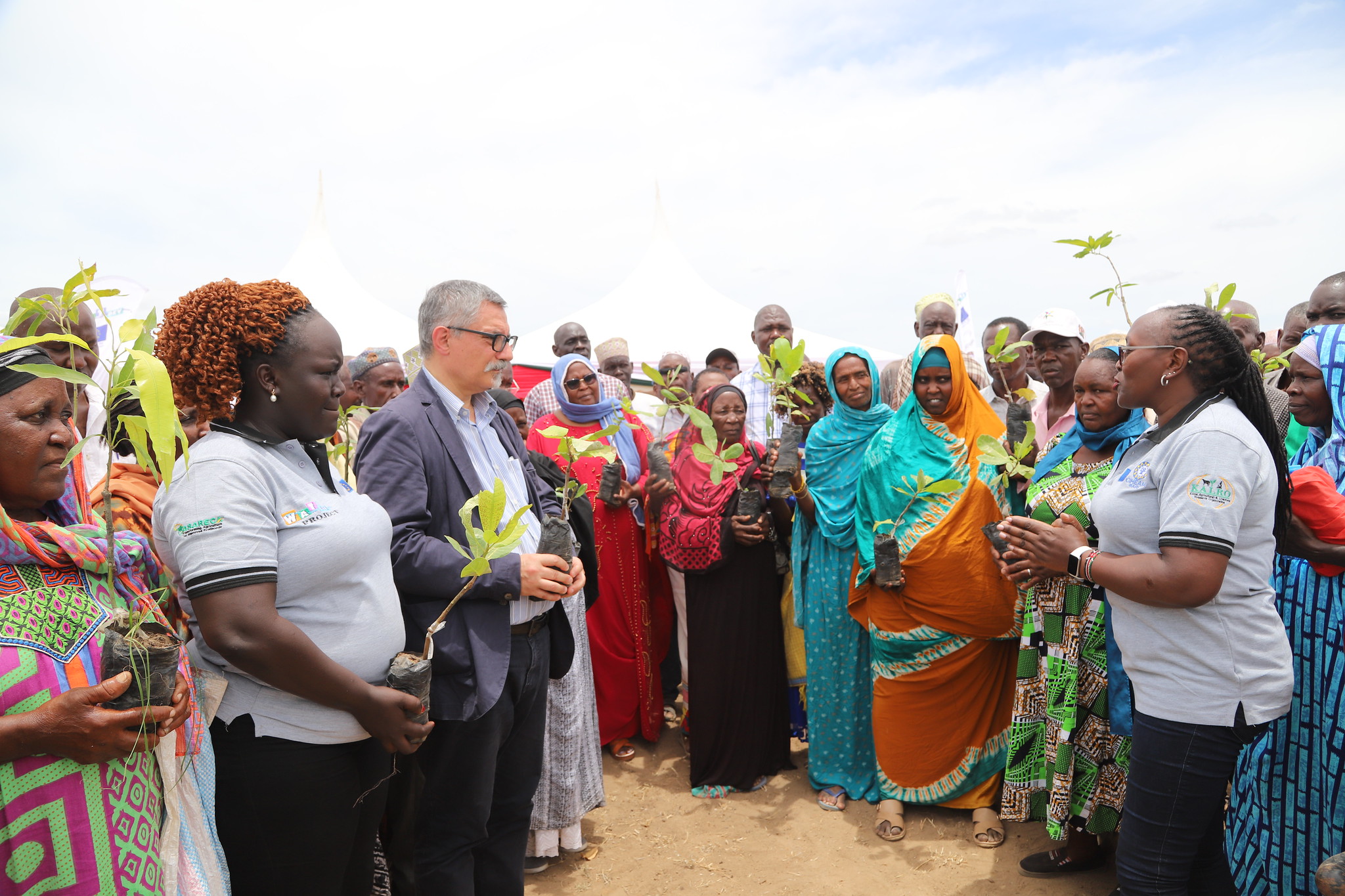
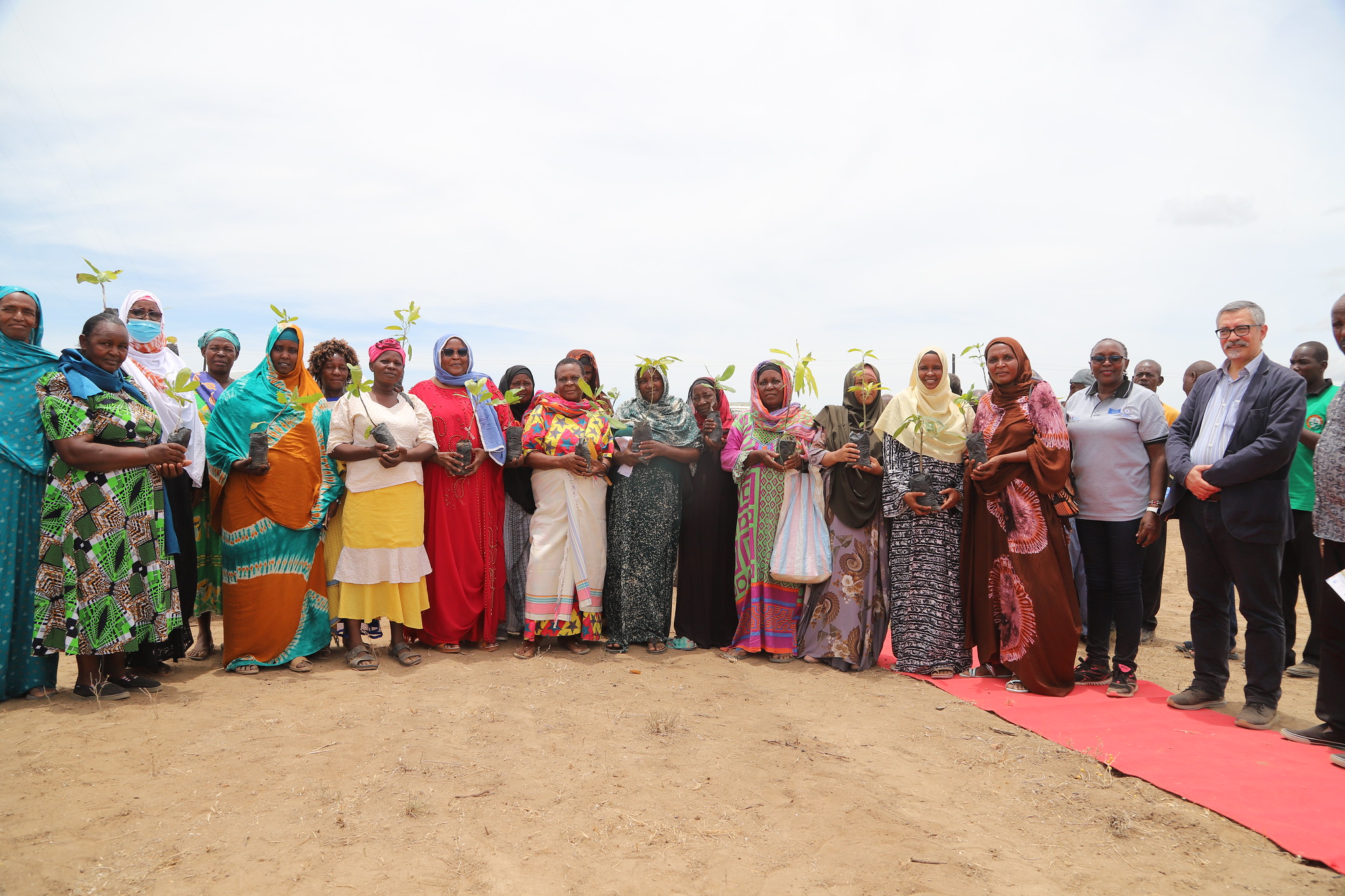
Agroforestry was a central theme for the event, with officials from ASARECA, KALRO, CIHEAM Bari, and the Tana River County Government leading a tree-planting campaign to improve soil health, conserve water, and promote sustainable farming practices. As part of this initiative, a total of 1,000 tree seedlings were distributed to farmers for planting in demonstration gardens, which will function as platforms for training and knowledge exchange on agroforestry. Women and Youth participation was highlighted during the event, as they are essential contributors to agriculture in Tana River County. Empowering them with knowledge of agroforestry, BMPs, and irrigation systems was identified as a critical step towards building resilient farming communities capable of adapting to the impacts of climate change. 

Key Speeches and Highlights:

Madam Mwanajuma Hiribae, Tana River County Executive Committee Member for Agriculture, led a tree-planting exercise alongside officials from ASARECA, CIHEAM- Bari, and KALRO. In her opening speech, she emphasized the importance of agroforestry and sustainable irrigation practices: 

She noted that ???Agroforestry is not just about planting trees; it???s about securing our future. Integrating trees into our farming systems improves soil health, conserves water, and builds resilience against climate change. Today, as we plant these trees in Tana River County during the ongoing #WATDEV Roadshow, we reaffirm our commitment to sustainable agriculture, ensuring that future generations inherit a land that is fertile, productive, and thriving.???

Opening Remarks from CIHEAM -Bari

The International Centre for Advanced Mediterranean Agronomic Studies-Institute of Bari (CIHEAM- Bari) was represented by the Project Manager, Dr. Gaetano Ladisa. Speaking on behalf of the Director of CIHEAM Bari, Dr. Maurizio Raeli, during the opening session, Dr. Gaetano emphasized the collaborative nature of the WATDEV Project: 

???On behalf of the Director of CIHEAM Bari, Dr. Maurizio Raeli, the Vice-Director, Dr. Biagio Di Terlizzi, the DeSIRA Programme Coordinator at CIHEAM, Dr. Claudio Bogliotti, and the entire WATDEV team, it is my pleasure to welcome all of you to this Follow-up Training and Roadshow under the WATDEV DeSIRA Project. 

???Your presence here today adds immense value to this joint initiative, reinforcing our connection with partners in Uganda, Egypt, Ethiopia, Sudan, and Europe. By fostering research, technology, and innovation, we contribute to the growth and development of the agricultural sector.??? 

Dr. Gaetano Ladisa further acknowledged the efforts of ASARECA and KALRO in organizing the event and expressed appreciation to all stakeholders for their dedication towards making the event a success.

Opening Remarks from ASARECA

Ms. Blaise Amony also delivered remarks on behalf of the WATDEV Coordinator, Mr. Moses Odeke. She reiterated the project’s dedication to training farmers, extension agents, and researchers as a means of catalyzing uptake and utilization of the BMPs. She noted that the event was part of WATDEV project Activity 2.4 (A2.4) ??? ???Training and Participatory Evaluation of BMPs/Innovations Implementation and Up-Out Scaling Assessment??? led by ASARECA

“The training workshop aims at imparting knowledge and skills to the farmers, extension agents, local researchers, and community members within the Hola area. We are committed to working with KALRO to ensure the project achieves its intended outcomes. Furthermore, the event also aims at outscaling the BMPs selected for Kenya, mainly Agroforestry and Water Management (Water Users Association), she noted.

On behalf of ASARECA, I would like to pledge our commitment to work together with KALRO to ensure that the project is successfully implemented to deliver the intended outputs and outcomes.??? 

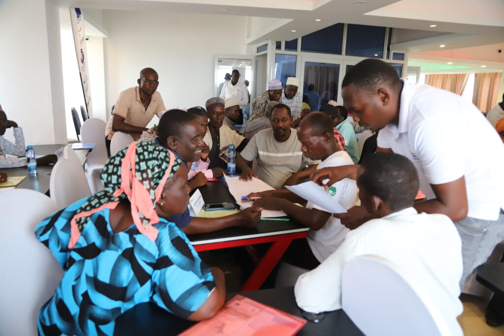
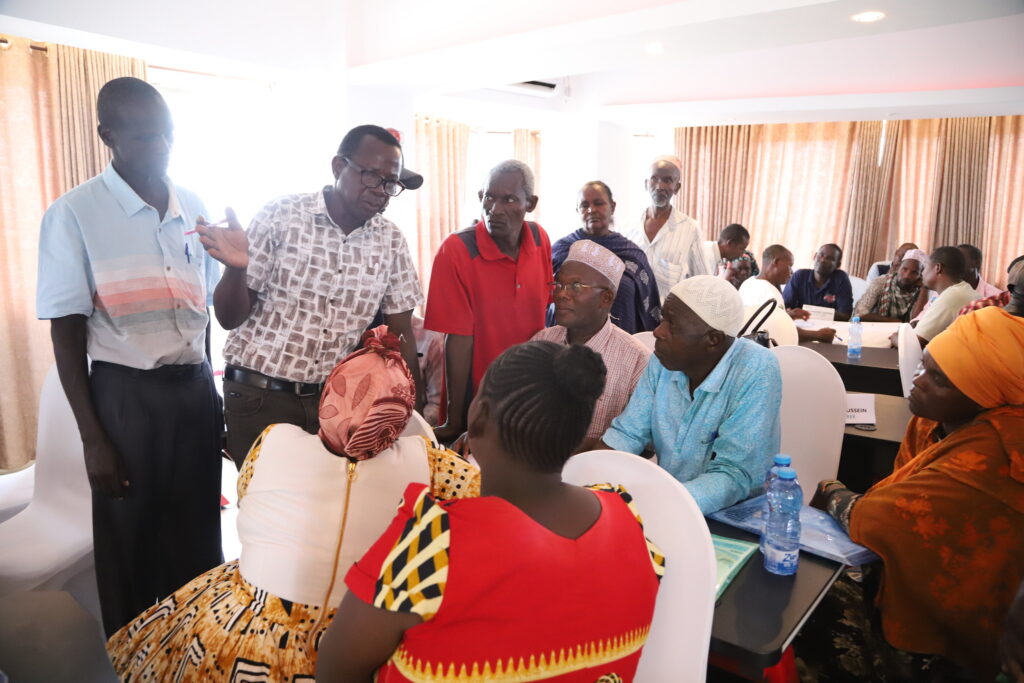
Training and Knowledge Sharing

Farmers in Tana River County continue to face critical water challenges, including prolonged droughts and limited access to reliable water sources. The introduction of the BMPs has provided a viable solution for addressing these challenges, while enhancing agricultural productivity and improving resilience to climate change in the region.

The WATDEV Project continues to support communities in Kenya, Ethiopia, Sudan, and Egypt to adopt innovative practices for a more resilient agricultural future. The Project is promoting Sustainable Water Management, Composting, Agroforestry Crop Rotation as BMPs to boost resilience to effects of climate change in the target countries while fostering sustainable soil and land management.

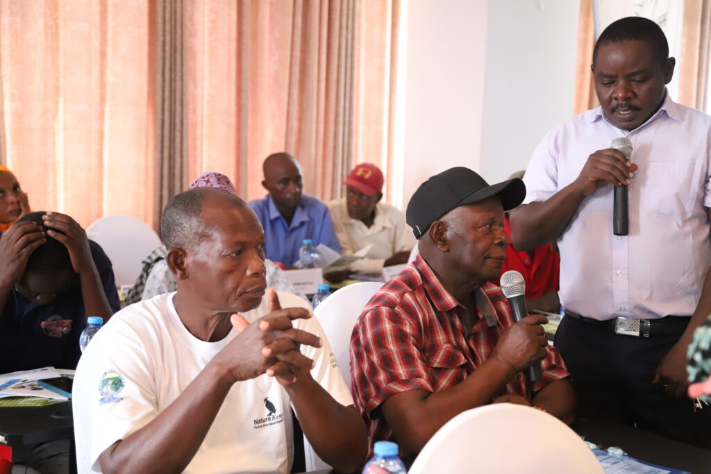
The event provided a valuable platform for farmers to share experiences, learn from each other, network with start-ups or innovators, and engage with other stakeholders in the agricultural value chain.

The success of the WATDEV Project Innovation Roadshow Event in Tana River County demonstrated the power of collaboration and innovation in building resilient agricultural systems for the future.

For more information about the WATDEV Project, visit their official website: [www.watdev.eu] (https://watdev.eu.eu/).

Flickr Album: https://flic.kr/s/aHBqjC6YRk

Pictures by Genevieve Apio ASARECA

Photo Album

Leave a Comment

Your email address will not be published. Required fields are marked *

Scroll to Top

Ude Kebele groundwater irrigation scheme under the Adaa Becho Groundwater Irrigation system (ABGIS) in the Awash Basin

It is a new intervention area with perspectives to be expanded. It is therefore envisaged that the lessons from other countries could be scaled out in this area.

Ada’a-Becho Groundwater Irrigation (ABGIS) is located in Ada’a Wereda some 50 km from Addis Ababa. The Adama road passes nearby the scheme and has no access limitation.  This scheme is part of Ada’a-Bacho Irrigation Development Project that comprises three conjugate Kebeles (i.e., Dhankaka, Ude and Qallitty) in Ada’a District of East Shawa Zone, Oromia Regional State.

The Ude Kebele Groundwater Irrigation Site is small, scheme selected to demonstrate groundwater irrigation practice demonstration sites as it is new irrigation development area will be a learning site for a medium scale community owned groundwater irrigation development in Ethiopia.

ABGIS landscape is one of the low reliefs that slopes gently north-west and south east wards. Apart from close to the hills virtually all slopes are nearly less than 3- 4%, with the majority of the slopes of 0-2%. 

The climatic variables of the project area are highly governed by the topography of the area (mainly altitude). The highland area lies at an altitude of over 2300 m asl and covers 17.5% of the project area. Mean annual temperature of this part of the project area ranges from 12.50C to 160C.

The major crops produced include Teff, chick pea, wheat, barley, vetch, and maize.  Few farmers also produce tomato and onion as cash crops. Crop production in the area is by and large rain-dependent. But in few farmers produce vegetables twice a year using pumped water from Mojo and Waddecha rivers.

The problems in ABGIS are connected with the limited experience in fruit crop production.

Koga Irrigation System (KIS) in the Abbay Basin

KIS is an established and relatively well performing irrigation scheme in Ethiopia. In here besides Irrigation water management, there are also success stories in watershed management.

Koga is located some 40 km from Bahri Dar town (Regional capital of Amhara Regional State. The  Bahir Dar –Addis Ababa highway passes through the scheme (Fig 2), hence the scheme is year round accessible.

Koga irrigation system comprises of 19.7 km of lined main canal, 52 km of lined secondary canals, 156 km of unlined tertiary canals, 905 km of unlined quaternary canals and 11 lined Night Storage Reservoirs (NSRs). The main canal was designed to provide irrigation water for 24 h during irrigation period.

There are 12 secondary canals designed for 12 h irrigation supply each covering an area of irrigated land ranging from 220 ha to over 1000 ha. Tertiary canals are designed for 12 h irrigation supply. The area irrigated by a tertiary canal range between 20 ha to 65 ha. The quaternary canals have a capacity of irrigating 8–16 ha of land while field canals will serve an area of 2.0 ha within the quaternary unit. The maximum field canal design capacity is 30 l/s.

KIS is the best performing among many community-managed irrigation schemes. Unlike other schemes this was designed and developed as an integrated watershed and irrigation development project.

Among the problems associated to the KIS are Seasonal water shortage and associated conflicts between Irrigation water user associations, low irrigation water application efficiency, catchment degradation. In order to increase water productivity in the KIS, water saving technologies will be promoted.

The Gezira irrigation scheme

The Gezira Scheme is located between the Blue Nile and the White Nile Rivers within a semi-arid agro-climatic zone. In terms of accessibility, it is easily accessible by Wad Medani road and the trip between Wad Medani, the capital of the Gezira State and headquarter of the scheme (Barakat), and Khartoum takes about three hours. The scheme is one of the largest irrigation schemes in the region with 880,000 hectares (ha). It is one of the main sources of foreign currency (cotton export), and food security (wheat, sorghum, vegetables) for Sudan. It has huge infrastructure with a value estimated at about US $ 8 billion. The scheme had played a vital role in the history of irrigation in Sudan and Africa and has become a model for many irrigation schemes in sub-Saharan Africa in terms of design and operation system. Therefore, any research aiming at improving water management in Gezira scheme is not only beneficial to the project, but also to similar projects at national and regional scale.  There are many challenges that the scheme face and urgent need to investigate Best Management Practices (BMPs) that  can overcome these challenges and enhance productivity. Some of these challenges are deterioration of irrigation infrastructure, inefficient water distribution within the scheme, agricultural drainage discharges directly in the Blue Nile without treatment impacting water quality, institutional weakness and instability.

Belbies district

Belbies district is located 20 km south of El Zagazig city between Long. 31o 24′ and 31o 39′ E and Lat. 30o 19′ and 30o 29′ N. It is bounded at the east by Abu Hammad, at the west by Minia El Kammh and in the south by the Tenth of Ramadan City districts.

As a part of the east Nile Delta, Belbies district constitutes a portion of an arid belt of north Egypt. It is characterized by a long dry summer and short temperate winter with a rainfall period from October to March. The climate is hot in summer; the average temperature is in the range of 19.7oC and 34.7oC, while during winter it ranges from 7.4oC and 18.4oC.

Due to intensive agricultural practice, which involves the application of chemical fertilizers and pesticides, many soils and shallow aquifers are contaminated. Consequently, pollution of groundwater has become a major concern in recent years. Wastewater disposed in canals can diffuse in groundwater. Overexploitation of groundwater and intensive irrigation in major canal commands has posed serious problems for groundwater managers in Nile Delta e.g. Sharkia governorate. The development of groundwater resources, technology-oriented management skills, adequate and efficient groundwater monitoring system, empowerment of women in unprivileged areas are among the challenges to be addressed. Indeed, water management projects are one of the priority topics in the political agenda of Egypt.