WATDEV Regional Workshop Held in Kenya to Validate Basin-Scale Water Management Scenarios

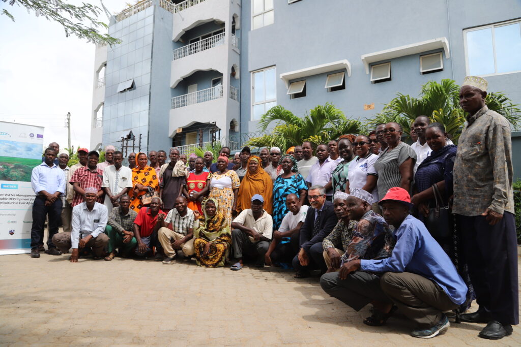
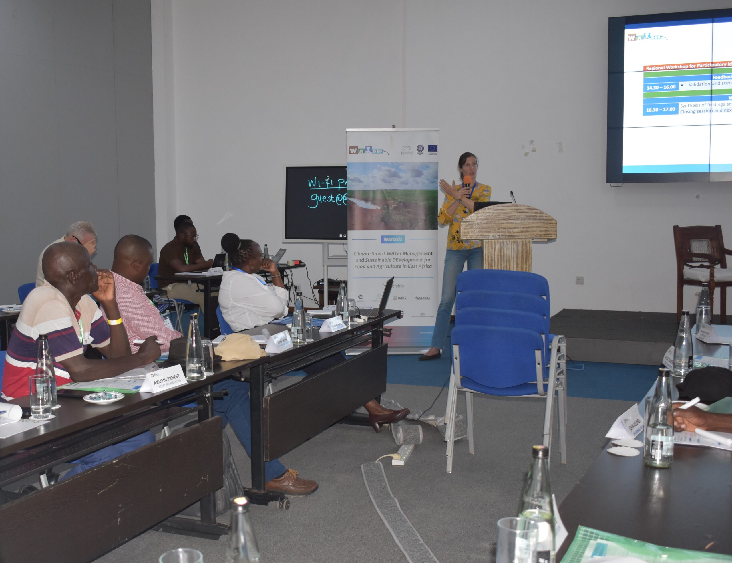
The Climate Smart Water Management and Sustainable Development for Food and Agriculture in East Africa (WATDEV) project, funded by the European Union, in the framework of the DeSIRA Initiative, advanced its regional engagement efforts with a Regional Workshop held in Malindi, Kenya, on 17 November 2025. The event was organized by the local partner, Kenya Agricultural and Livestock Research Organization (KALRO), in collaboration with ASARECACIHEAM-Bari, and the Tana River County Government.

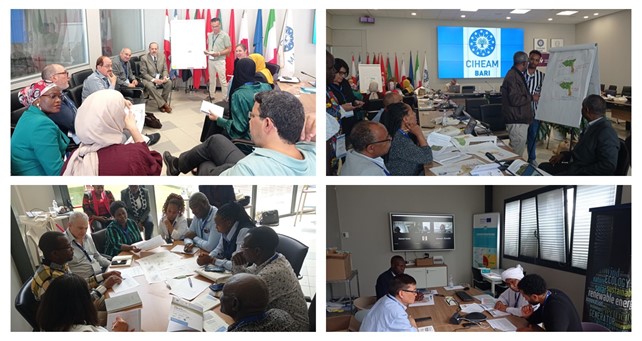
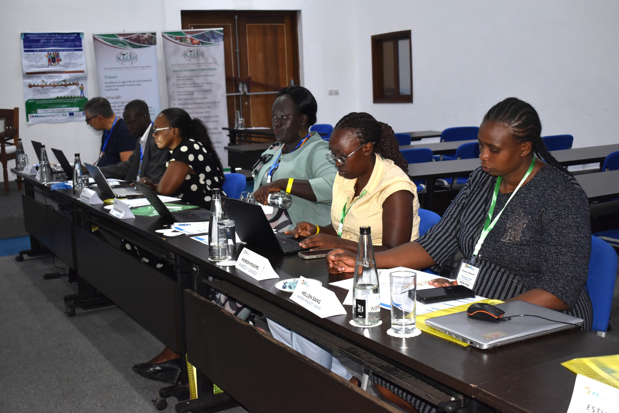
The workshop brought together regional planners, researchers, decision makers, ministry officials, technical experts, stakeholders, and project partners to validate the Best Management Practices (BMPs) scenarios developed for basin-scale application in Kenya, ensuring they reflect local realities, community priorities, and support long-term climate-resilient development.

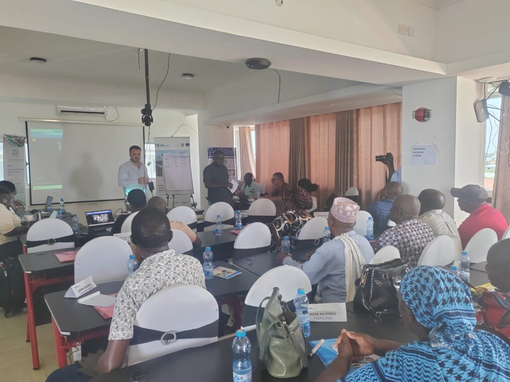
The day opened with remarks by Mr. Moses Odeke, Interim Head of Programs of ASARECA, who described the workshop as a defining moment in the implementation of the WATDEV Project. This was followed by Dr. Gaetano Ladisa, WATDEV Project Manager at CIHEAM-Bari, highlighting the significance of the workshop as a key moment for jointly validating BMPs at the basin level. This workshop – he said – represents a key step in moving from localized assessments to basin-wide planning, marking a transition toward integrated, evidence-based, and participatory water and land management strategies. Dr. Alice Murage, Deputy Director General for Crops at KALRO, emphasized the project???s strong participatory approach. She affirmed that WATDEV has fully engaged stakeholders in co-creation to enhance ownership, applicability, and long-term sustainability of the proposed solutions.

The workshop was officially inaugurated by Hon. Mwanajuma Hiribae, CECM for Agriculture in Tana River County. She underscored the region???s vulnerability to floods and droughts, which continue to disrupt agricultural productivity and food security. She welcomed the WATDEV initiative as a timely effort to strengthen climate resilience and sustainable agriculture, and pledged the County???s full commitment and support.

A key speech address by Dr. Jacopo Tavassi, AICS???EU Portfolio Coordinator at AICS Cairo, set the tone for the day. He stressed that the workshop represents a critical convergence of scientific modelling, policy dialogue, and field experience, helping determine what can truly be scaled and adopted by farming communities. He highlighted that sustainability must be paired with scalability, reaffirming the need for technically sound and socially acceptable BMPs. Dr. Tavassi also emphasized AICS???s ongoing commitment to support WATDEV, noting that although much of AICS???s contribution happens behind the scenes, it remains essential, from audit and compliance to ensure transparency and accountability, to monitoring and evaluation that document progress and learning, and communication efforts that make evidence and results visible and credible for all.

Participants also received an update on project progress from Ms. Concetta Bianco, WATDEV Project Coordinator at AICS Cairo, who presented recent achievements and upcoming implementation plans. Her presentation reinforced the value of multi-country collaboration in generating shared climate-smart water management solutions.

Dr. Jantiene Baartman from ISRIC later outlined the methodology used to simulate BMPs/scenarios at the basin level. This provided participants with a clear understanding of how previous stakeholder inputs, collected during case-study engagement activities, were translated into robust modelling outputs. 

Following these presentations, the workshop moved into the core of the workshop, focused on the technical results of modelling BMPs. Participants were introduced by Dr. Aymen Sawassi, from CIHEAM-Bari, to the outcomes of the simulated BMPs/scenarios, with particular emphasis on the two key BMPs in Kenya: The Agroforestry, including the expansion of mango trees and the use of hedgerow trees as windbreaks, and the Water Users??? Association (WUA). An open Q&A ensured that all stakeholders shared a common understanding of the technical implications and modelling assumptions behind each scenario. Dr. Luuk Fleskens from ISRIC complemented the simulation results with the economic assessment of the BMPs, conducted through the post-processing analysis.

KALRO???s and Tana River County???s staff facilitated the interactive group exercise that engaged participants in discussions, analysis, and refinement of the proposed scenarios, identifying enabling conditions, feasibility considerations, and potential barriers to implementation. This participatory validation generated crucial basin-specific information that would not be accessible through modelling alone.

To complement the qualitative dialogue with the participating organizations, Ms. Silvia Lecci from CIHEAM Bari conducted a survey on water management policy improvements. This survey is intended to examine the stakeholders??? perception of the direct or indirect contribution that the modelling toolbox can have on policy and/or governance models improvement in the field of water management in agriculture in Kenya. 

The day concluded with a synthesis of findings, outlining the key recommendations, scenario refinements, and priorities emerging from the participatory discussions and engagement. A roadmap was presented for integrating stakeholder inputs into updated basin-level simulations under the WATDEV framework.

Overall, the Regional Workshop in Kenya represented a critical milestone for WATDEV. By combining advanced modelling with participatory validation, the event ensured that basin-scale BMP scenarios are not only technically robust but also socially grounded, institutionally relevant, and aligned with real implementation conditions. This collaborative process strengthens the WATDEV modelling toolbox and paves the way for more climate-resilient and sustainable agricultural water systems across Eastern Africa.

Photo Album

Leave a Comment

Your email address will not be published. Required fields are marked *

Scroll to Top

Ude Kebele groundwater irrigation scheme under the Adaa Becho Groundwater Irrigation system (ABGIS) in the Awash Basin

It is a new intervention area with perspectives to be expanded. It is therefore envisaged that the lessons from other countries could be scaled out in this area.

Ada’a-Becho Groundwater Irrigation (ABGIS) is located in Ada’a Wereda some 50 km from Addis Ababa. The Adama road passes nearby the scheme and has no access limitation.  This scheme is part of Ada’a-Bacho Irrigation Development Project that comprises three conjugate Kebeles (i.e., Dhankaka, Ude and Qallitty) in Ada’a District of East Shawa Zone, Oromia Regional State.

The Ude Kebele Groundwater Irrigation Site is small, scheme selected to demonstrate groundwater irrigation practice demonstration sites as it is new irrigation development area will be a learning site for a medium scale community owned groundwater irrigation development in Ethiopia.

ABGIS landscape is one of the low reliefs that slopes gently north-west and south east wards. Apart from close to the hills virtually all slopes are nearly less than 3- 4%, with the majority of the slopes of 0-2%. 

The climatic variables of the project area are highly governed by the topography of the area (mainly altitude). The highland area lies at an altitude of over 2300 m asl and covers 17.5% of the project area. Mean annual temperature of this part of the project area ranges from 12.50C to 160C.

The major crops produced include Teff, chick pea, wheat, barley, vetch, and maize.  Few farmers also produce tomato and onion as cash crops. Crop production in the area is by and large rain-dependent. But in few farmers produce vegetables twice a year using pumped water from Mojo and Waddecha rivers.

The problems in ABGIS are connected with the limited experience in fruit crop production.

Koga Irrigation System (KIS) in the Abbay Basin

KIS is an established and relatively well performing irrigation scheme in Ethiopia. In here besides Irrigation water management, there are also success stories in watershed management.

Koga is located some 40 km from Bahri Dar town (Regional capital of Amhara Regional State. The  Bahir Dar –Addis Ababa highway passes through the scheme (Fig 2), hence the scheme is year round accessible.

Koga irrigation system comprises of 19.7 km of lined main canal, 52 km of lined secondary canals, 156 km of unlined tertiary canals, 905 km of unlined quaternary canals and 11 lined Night Storage Reservoirs (NSRs). The main canal was designed to provide irrigation water for 24 h during irrigation period.

There are 12 secondary canals designed for 12 h irrigation supply each covering an area of irrigated land ranging from 220 ha to over 1000 ha. Tertiary canals are designed for 12 h irrigation supply. The area irrigated by a tertiary canal range between 20 ha to 65 ha. The quaternary canals have a capacity of irrigating 8–16 ha of land while field canals will serve an area of 2.0 ha within the quaternary unit. The maximum field canal design capacity is 30 l/s.

KIS is the best performing among many community-managed irrigation schemes. Unlike other schemes this was designed and developed as an integrated watershed and irrigation development project.

Among the problems associated to the KIS are Seasonal water shortage and associated conflicts between Irrigation water user associations, low irrigation water application efficiency, catchment degradation. In order to increase water productivity in the KIS, water saving technologies will be promoted.

The Gezira irrigation scheme

The Gezira Scheme is located between the Blue Nile and the White Nile Rivers within a semi-arid agro-climatic zone. In terms of accessibility, it is easily accessible by Wad Medani road and the trip between Wad Medani, the capital of the Gezira State and headquarter of the scheme (Barakat), and Khartoum takes about three hours. The scheme is one of the largest irrigation schemes in the region with 880,000 hectares (ha). It is one of the main sources of foreign currency (cotton export), and food security (wheat, sorghum, vegetables) for Sudan. It has huge infrastructure with a value estimated at about US $ 8 billion. The scheme had played a vital role in the history of irrigation in Sudan and Africa and has become a model for many irrigation schemes in sub-Saharan Africa in terms of design and operation system. Therefore, any research aiming at improving water management in Gezira scheme is not only beneficial to the project, but also to similar projects at national and regional scale.  There are many challenges that the scheme face and urgent need to investigate Best Management Practices (BMPs) that  can overcome these challenges and enhance productivity. Some of these challenges are deterioration of irrigation infrastructure, inefficient water distribution within the scheme, agricultural drainage discharges directly in the Blue Nile without treatment impacting water quality, institutional weakness and instability.

Belbies district

Belbies district is located 20 km south of El Zagazig city between Long. 31o 24′ and 31o 39′ E and Lat. 30o 19′ and 30o 29′ N. It is bounded at the east by Abu Hammad, at the west by Minia El Kammh and in the south by the Tenth of Ramadan City districts.

As a part of the east Nile Delta, Belbies district constitutes a portion of an arid belt of north Egypt. It is characterized by a long dry summer and short temperate winter with a rainfall period from October to March. The climate is hot in summer; the average temperature is in the range of 19.7oC and 34.7oC, while during winter it ranges from 7.4oC and 18.4oC.

Due to intensive agricultural practice, which involves the application of chemical fertilizers and pesticides, many soils and shallow aquifers are contaminated. Consequently, pollution of groundwater has become a major concern in recent years. Wastewater disposed in canals can diffuse in groundwater. Overexploitation of groundwater and intensive irrigation in major canal commands has posed serious problems for groundwater managers in Nile Delta e.g. Sharkia governorate. The development of groundwater resources, technology-oriented management skills, adequate and efficient groundwater monitoring system, empowerment of women in unprivileged areas are among the challenges to be addressed. Indeed, water management projects are one of the priority topics in the political agenda of Egypt.